Лазерное сканирование
Технология получения трехмерной модели
окружающего пространства с помощью лазерного сканирования.
Лазерное сканирование
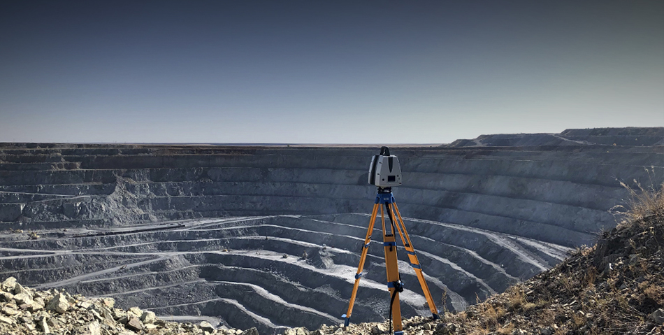
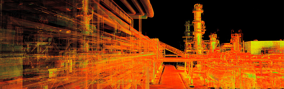
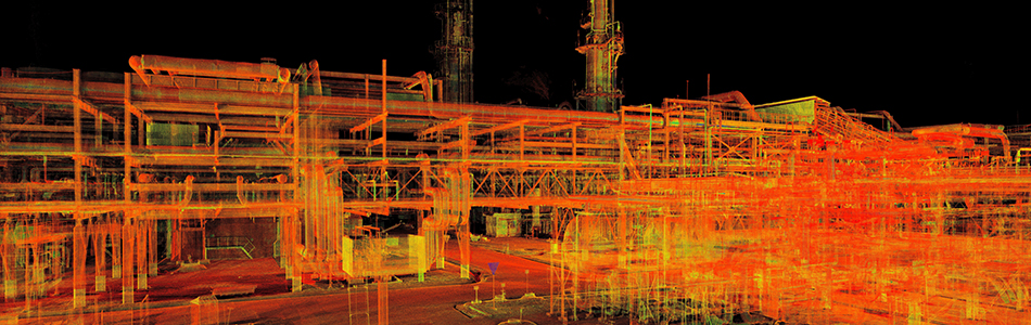
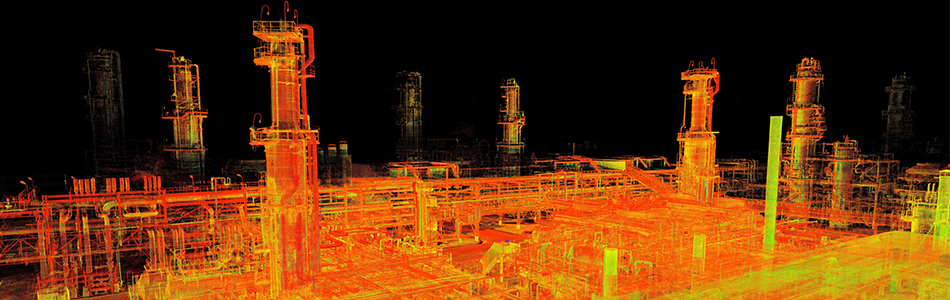
— используется везде, где нужно получить точную и детальную трехмерную геометрию объекта, и это один из наших главных сервисов. Мы сканируем как сравнительно небольшие объекты (квартиры и офисы, фасады зданий), так и крупные инфраструктурные объекты (стадионы, аэропорты, дорожные развязки) и даже целые промышленные предприятия.
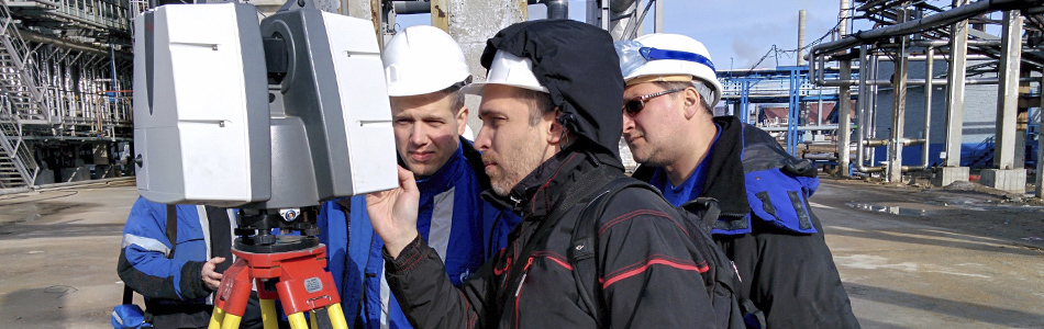
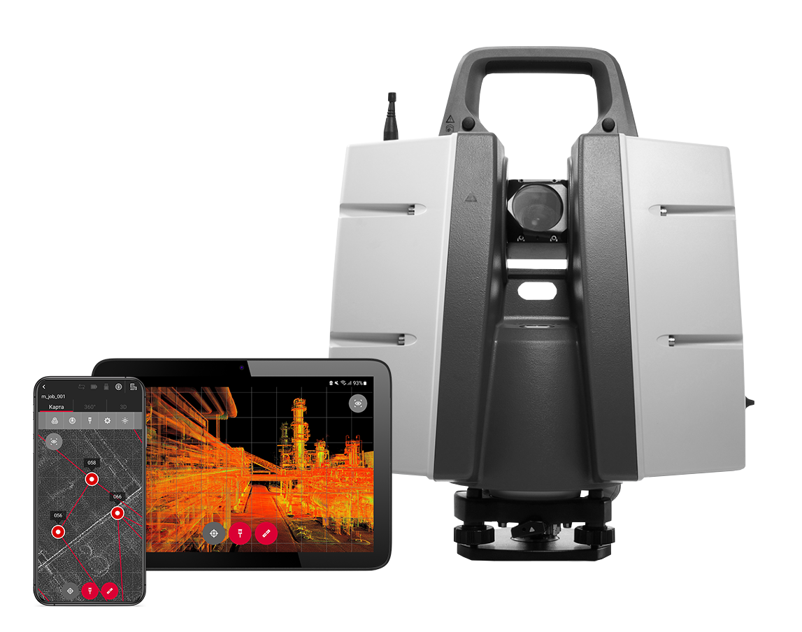
Еще 10 лет назад сканер представлял из себя сложное техническое устройство, а управление требовало специальных навыков. Современный сканер — компактный, быстрый, простой в управлении прибор. Тем не менее, качественно сделать лазерное сканирование — по-прежнему непростая задача. С какими вопросами сталкивается заказчик и исполнитель работ по ЛС?
- Качественное техническое задание. Даже опытным компаниям-заказчикам часто сложно четко сформулировать, какой и зачем нужен конечный результат. Исполнитель на основе своего опыта помогает правильно поставить задачу и обеспечить максимально эффективное использование результатов проекта по ЛС.
- Расчет объема работ, корректная оценка времени и ресурсов, необходимых для съемки объекта. А результатом неправильной оценки можем стать либо слишком высокая цена, которая заставит заказчика отказаться от проекта, либо слишком низкая, что почти всегда сказывается на качестве выполненных работ.
- Работа с большими проектами. Постоянный мониторинг строительства в течение нескольких лет, ЛС сотен гектар промышленных объектов – такие задачи требуют особых навыков, таких как возможность организовывать и синхронизировать работу нескольких бригад с приборами, наличие мощных компьютерных ресурсов по обработке облаков, специальные лайфхаки по работе с большими объемами данных. Далеко не каждый исполнитель способен выполнить подобную работу.
Почему Триметари Консалтинг, как исполнитель работ по лазерному сканированию, – номер один в России?
- 200+ выполненных проектов и 100+ лет совокупного опыта специалистов.
- Уникальный опыт выполнения действительно больших и сложных проектов. Наш последний рекорд – трехмерная съемка 8 км2 многоуровневой промышленной территории в рамках одного проекта.
- Внутренняя система оценки объема и сложности работ, выработанная на основе многолетнего опыта — поэтому мы никогда не промахиваемся со сроками и всегда даем качественный результат.
- Мощные компьютерные ресурсы для обработки данных, без которых действительно большие проекты сделать невозможно.
- Собственный облачный сервер для хранения и обработки данных, которым могут пользоваться в том числе и наши клиенты.
- 4 собственных сканера от швейцарской Leica Geosystems, ведущего производителя решений по ЛС — на сегодняшний момент это самое производительное “железо” в мире.
И, наверное, лучшим признанием наших достижений является тот факт, что уже несколько раз за свою историю мы помогали создавать собственные внутренние методики по внедрению технологий ЛС для повышения эффективности бизнес-процессов в крупных промышленных компаниях.