Archaeology
Terrestrial laser scanning is a unique non-contact technology that allows to obtain a 3D model of an object with high speed, accuracy and detail. Laser scanning in archaeology is used for various tasks:
- fixation,
- visualization,
- localization,
- museification, creation of interactive virtual expositions.
Fixation
Fixation of archaeological material is an integral part of monument research, as the cultural layer is completely lost during excavations. Methods of fixation in archaeology have been developing in parallel with the archaeological science itself, and this process continues to the present day.
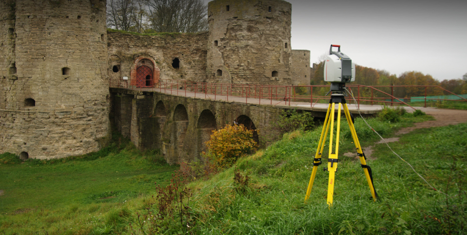
One of the most modern methods of fixation in archaeology is terrestrial laser scanning. The speed with which 3D laser scanning performs excavation survey in the field is especially demanded in conservation archaeology, when work is carried out according to a time schedule.
The primary result of laser scanning is a point cloud. Already this material contains metric information about the scanned object with millimeter detail.
The point cloud can be imported into standard CAD systems, such as AutoCAD, and an archaeological plan, section, or any geometric information can be extracted. If for any reason the point cloud processing capability is not available now, it can be used later – the point cloud is an accurate and highly detailed impression of the real object, a virtual copy that stores spatial information indefinitely.
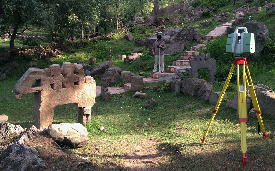
This laser scanning capability – to quickly, qualitatively, and without human error record the condition of an archaeological site – is used to archive data on endangered cultural monuments.
Visualization
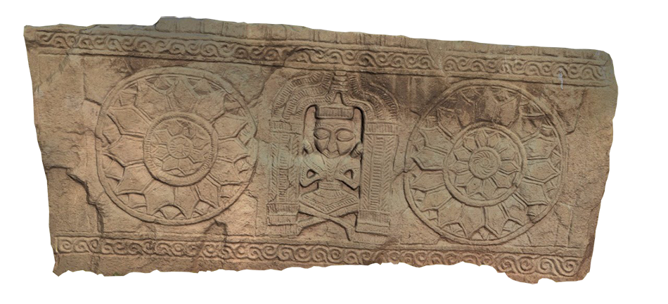
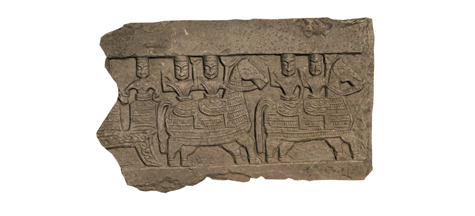
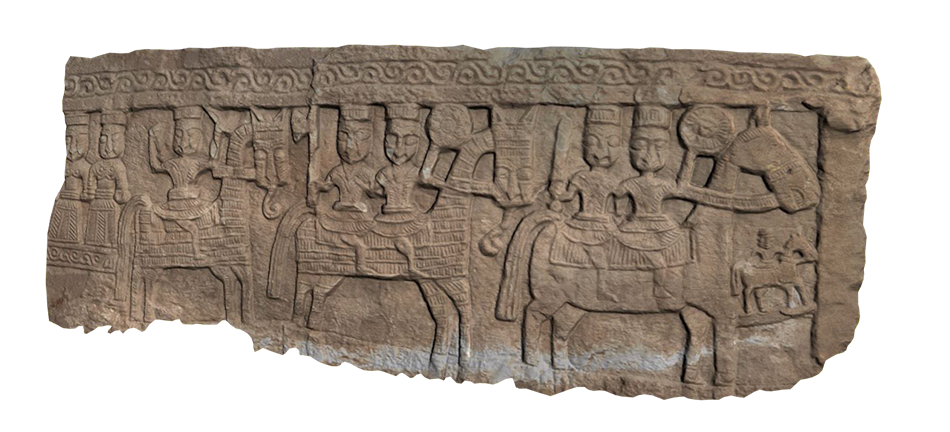
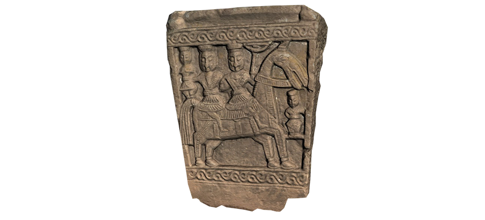
The point cloud can be used not only to draw up an archaeological plan, but also to create a full 3D model of the excavation. A three-dimensional model creates a more visual, vivid representation of the archaeological site. 3D-model also carries all metric characteristics, there is also an opportunity to overlay texture, taken by the built-in 3D scanner camera or a third-party camera. The obtained model can be used for scientific reconstruction, demonstration, recorded on disk and put into a monograph, given to colleagues, handed over to the archive, or published on the website.
Localization
The micro-relief of the terrain obtained from laser scanning data can tell us a lot about what is hidden. Point cloud processing software can filter out vegetation, buildings and structures, leaving only the ground surface.
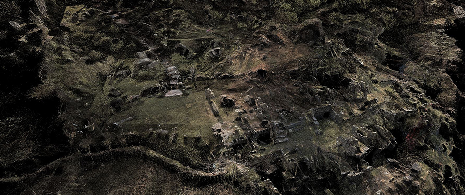
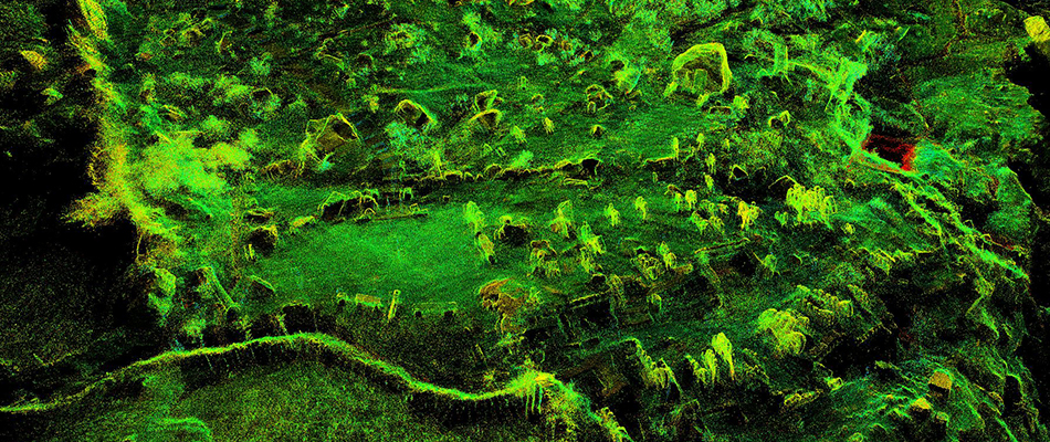
Recently, an interdisciplinary approach to the study of a monument has become increasingly popular in archaeology. The advantages to be gained from the combined use of several methods are obvious. Based on the idea of joint data processing of archaeological reconnaissance methods to solve the problem of localization, laser scanning solves the problem of surveying microrelief before archaeological excavations. Joint superimposition of microrelief maps, electrical survey, geomagnetic survey often allows to localize quite accurately the location of hidden objects, which allows to plan archaeological works and save the budget.
Museification, creation of virtual expositions
Virtual tour, virtual museum, or interactive 3D-application is a multimedia software product that immerses in virtual reality, created on the basis of real or fictional, virtually reconstructed objects and presents the museum exposition in electronic form.
The object can be an existing museum exposition, a separate architectural monument or a whole neighborhood, a historical scene in the past, a remote or hard-to-reach object.
On the territory of virtual reality you are given full freedom of action: walking, flying around and inspecting the object, getting acquainted with the interior, landscape, multimedia interaction with virtual reality objects: receiving information, controlling the weather, time of year and time of day. It is possible to use animation, play scenarios. High realism is achieved by working out high-quality, detailed textures, selecting sound accompaniment (birdsong, surf noise, highway sounds), using animated objects (cars, pedestrians, animals), using advanced algorithms for modeling the physical world.
Due to the immersive effect, visual appeal, and information component, interactive 3D applications contribute to the implementation of outreach, educational and popularization activities.
In an interactive 3D-application it is possible not only to study a museum object visually, but also to actively interact with it. For example, get descriptive information, historical reference, measure dimensions, see and hear the exhibit in action in different surroundings and in different states. It is possible to create a catalog of exhibits with the functions of viewing, searching, sorting.
With the help of modern technologies in virtual reality it is possible to present both real objects and nonexistent (or existed in the past). A combination of different states of one object is available with the possibility of simple switching.
The software developed by our company allows you to supplement the virtual scene with additional information. For example, text, audio or video description, as well as any other information can be obtained by simply clicking on the object without leaving the scene. The program fully engages the user and leaves a vivid impression as if visiting a real place.
Part of the work on exploring the virtual object, obtaining information about it, the user performs independently, which leads to increased involvement and trust. A high level of involvement in the process of cognition leads to increased memorization, quality assimilation of information.
Virtual tours can become, to some extent, a medium of communication between users and museum staff, which will allow communication with the public at a qualitatively different level, promptly collect wishes and recommendations of visitors.
Virtual reality expands the boundaries of museum activity, makes natural history, material and spiritual culture monuments accessible for people with disabilities.
The following variants of using interactive 3D-applications are the most widespread:
- Virtual tours – a programmed scenario of moving around a 3D scene. The user in a virtual excursion can be accompanied by a 3D virtual character playing the role of a guide. The excursion can be accompanied by sound design, subtitles. During the excursion, the user is not only immersed in the environment, but also demonstrates the exhibits in the most adequate way for them. The virtual excursion can be placed on the museum website, on a stationary computer (in the form of a DVD) or on a mobile device.
- Embedding into an existing exposition. A virtual reality installation is a personal computer with an interactive 3D-application installed and a computer-user interface with an immersive effect. For example, a stereo projector, a 3D monitor or a virtual reality helmet.
- Organization of access to museum values. A virtual museum can become a platform for sharing scientific data. With the help of laser scanning technology it is possible to create a geometrically and visually accurate copy of an exhibit, from a small coin to a large architectural object. The data posted for general access of scientific specialists can serve as a basis for new works and discoveries.