Mining
Currently, various measurement methods are used in geodetic works: aerial photography, satellite GNSS survey, total station survey, specialized measurement methods. Each method has its own peculiarities, advantages and disadvantages. Often on large projects a combination of them is used to achieve maximum efficiency. In this article we will talk about the most modern of existing methods – terrestrial laser scanning.
Terrestrial laser scanning in geodesy and surveying is used for:
- geodetic surveys,
- construction and installation control, executive surveying, comparison of the actual object with the project,
- measuring volumes of: excavated soil, bulk material storage, earthworks.
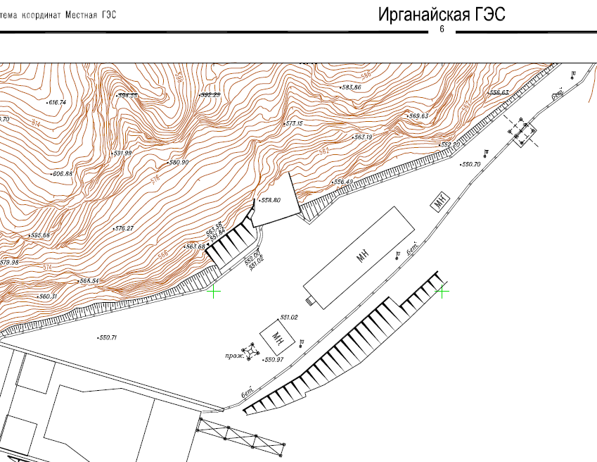
Conducting geodetic surveys
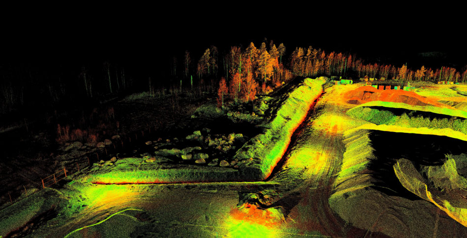
The undeniable advantage of the results of surveys obtained by laser scanning is their initial three-dimensional character. That is, in addition to the traditional topographic plan with elevation marks, it is possible to obtain a highly detailed digital elevation model (DEM), which greatly facilitates further design in CAD.
Laser scanning is of particular importance in the design of reconstruction and repair. Complex measurements at an existing facility are greatly simplified when using highly automated laser surveying.
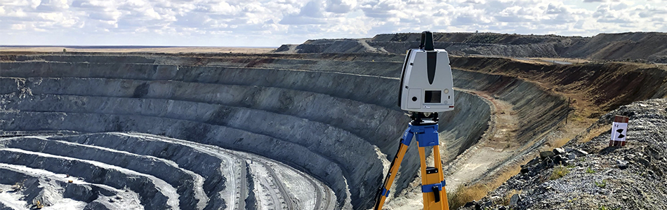
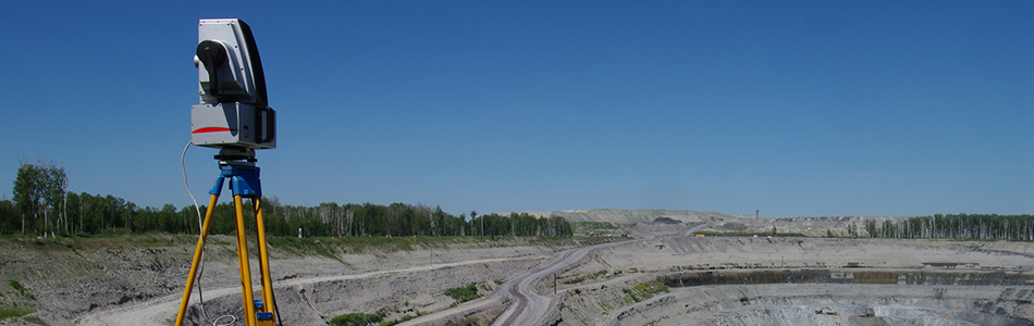
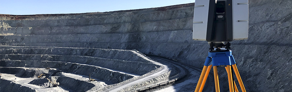
Laser scanning has the property of remoteness (non-contact) of measurement, the surveyor does not need to be on hard-to-reach and dangerous objects – laser 3D-scanner will remove the surface remotely. This factor is of great importance when surveying landslide- and rockfall-prone slopes, open-pit mining, mountainous terrain in general, objects with a strict schedule of heavy machinery operation.
Control of objects under construction (built), comparison of the actual object with the project
When controlling the construction of industrial and civil buildings and structures, roads, railroads, bridges, tunnels, it is advisable to use laser scanning. The main advantage of 3D-scanning in this case is the efficiency of the obtained data. On objects with high construction rates, high density and a large number of control objects, it is necessary to keep a team of specialists who take measurements on a daily basis. In addition to the high cost of such works, the human factor is inevitable, which leads to delayed deadlines and increased cost of construction works. The use of terrestrial laser scanning allows minimizing the influence of human factor due to the high degree of automation of the data collection process.
To build an actual “as is” or “as built” three-dimensional model of the controlled object in cases where the objects of control are not units of points, but hundreds and thousands of geometric parameters, it is advantageous to use laser scanning. According to this model, with high accuracy corresponding to reality, it is possible to carry out measurements in comfortable office conditions, without traveling to the object. Often certain parameters on the real object are simply impossible to measure, while on the virtual model they are taken in seconds.

An important aspect is the high degree of automation in scanning data processing. It is possible to build, for example, a set of cross sections at 20 m, 2 m, 20 cm intervals on the scanned model of a linear object – the operator sets only the interval, the sections are generated automatically and require only further processing.
Measurement of volumes: excavated soil, bulk material stockpiles, excavation work
During excavation work, it is sometimes difficult to calculate the volume of soil actually moved. Operational measurements with a laser scanner successfully accomplish this task. By accurately recording the surface microrelief, the scanner determines the volume of excavated/compiled soil and bulk material.
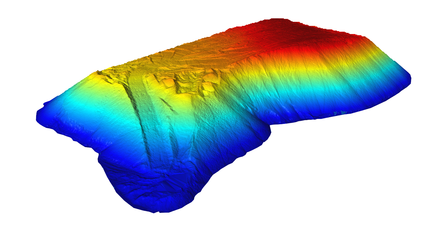
In case of cyclic nature of works there is a possibility to compare DEMs of different periods. In this case, not only the volume of moved material is calculated, but also mapping – determining the location of changes that occurred. The use of laser scanning to measure the volume of bulk materials in warehouses can significantly increase the accuracy of the final result.
Final result format
Upon completion of the work, the following materials may be handed over to the customer:
- topographic terrain plan M1:1000, M1:500 and larger,
- DEM in DWG, DGN, STL, OBJ, VRML, X3D, U3D, PLY formats,
- point model (point cloud),
- set of various measurements in tabular form (coordinates, distances, radii, areas, volumes, slopes, etc.),
- map of deviations of the real object from the project,
- three-dimensional model in a game environment (“wanderer”), a video clip with a hall,
- report on the work performed, including a report on the construction of the survey network, a report on georeferencing, a report on accuracy check.
Laser Scanning Services
Trimetari Consulting has extensive experience in the application of laser scanning in surveying and mining. Information about some of the completed projects is available in the Projects section. To obtain a complete reference list, confirming the qualification of the company, to order laser scanning services, to find out the cost of laser scanning, please contact us through the Contact Us page.