Architecture
Terrestrial laser scanning in architecture is in demand due to its high accuracy, speed of measurement, millimeter detail and lack of human error. Historically, laser scanning was used in architectural measurements for restoration of monuments, in surveying for installation of facade systems, in recent years, due to the growing popularity of BIM approach to design (Building Information Modeling), laser scanning is increasingly used to create a basis for design in Autodesk Revit.
Architectural Measurements
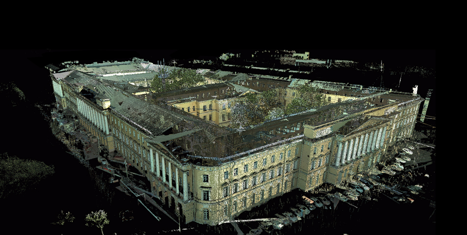
Laser scanning is used during the architectural survey stage. The scanning method is used for architectural or architectural and archaeological measurement of a building or structure. The result of scanning is both flat two-dimensional drawings (facades, plans, sections, details, fragments, templates) in electronic form and a three-dimensional model of the object.
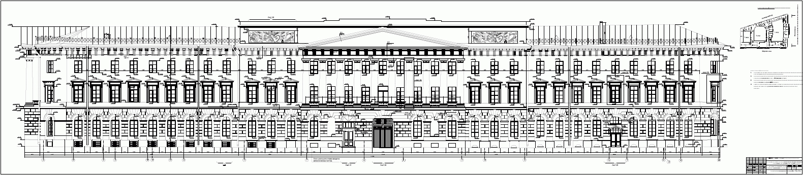
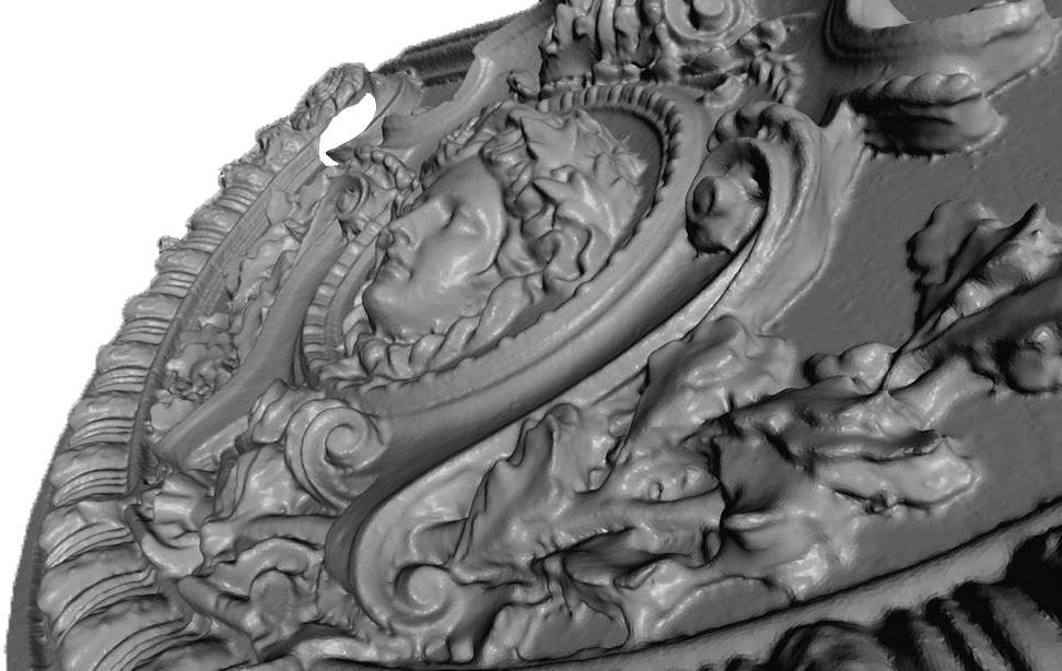
Compared to the manual method, architectural measurement by laser scanning does not require the erection of scaffolding, measurement drawings are much more accurate, because the human factor is minimized, and the accuracy of the device itself cannot be compared with a tape measure or plumb line. Photogrammetric method with the use of special devices – phototheodolites – is devoid of most of the disadvantages of manual measurement, but has its own inconveniences, the main of which is the limitation in measuring the third coordinate. Often architectural measurement is performed using a total station, the method is working, but up to a certain category of complexity of the building – bas-reliefs, stucco, templates to remove the total station is very difficult, and in some cases – impossible. Total station performs one measurement in a few seconds, 3D laser scanner performs hundreds of thousands of measurements per second with complete absence of human intervention.
When using a laser scanner, the field stage is reduced many times, there is independence from external lighting, and it is possible to work in the dark. Another important advantage is the initial three-dimensionality of the obtained data, which can be freely loaded into modern CAD systems, such as AutoCAD or Revit. The redundancy of the laser scanning result – point cloud – makes it possible to visit the object only once, without conducting additional domers.
Designing with BIM
Terrestrial laser scanning is currently the most effective technology for obtaining a 3D model of a building at any of the construction phases for subsequent use in BIM. Laser scanning is used in BIM in two cases:
- To create a sub-base for renovation, in this case laser scanning of an existing building is performed and based on this data (point clouds or 3D models) the design is performed in a BIM system, Autodesk Revit for example.
- To control construction and installation work, by means of 3D-scanning in this case, an operational survey of the construction object is carried out at a given interval, for example, once a month. According to the data of laser scanning it is possible to determine what is built, how it is built, to adjust the calendar schedule, to identify errors of construction and installation at the initial stage.
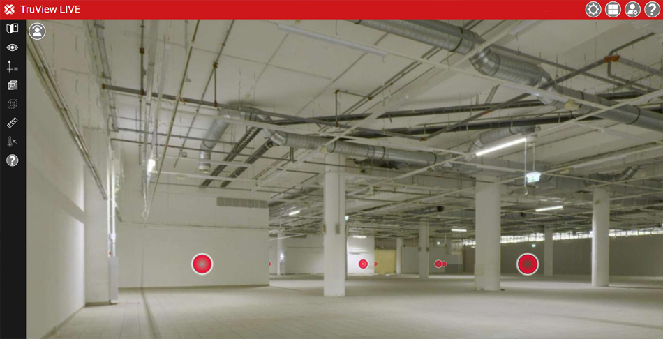
BIM assumes joint work on the architectural project of various specialists: engineers, architects, managers. There is a great opportunity to visualize the point cloud as spherical panoramas (Leica Truview or TetraVis).
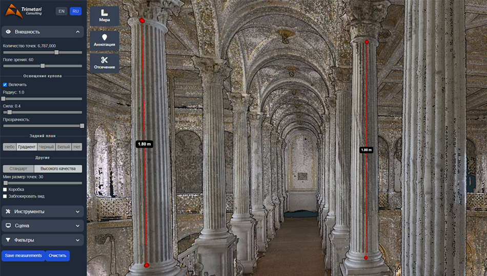
Panoramas can be measured, annotated, and most importantly, the object is visible, understandable and accessible via browser.
Curtain-type ventilated facades
For the installation of a ventilated facade, it is necessary to measure the existing building structures. Terrestrial laser scanning is ideally suited for this task. One of the advantages, in addition to the speed and accuracy of the measurement, is the three-dimensional nature of the data obtained: not only the dimensions of the objects, but also the deviation from the vertical plane can be indicated on the facade measurement.
Interactive 3D applications and virtual reality systems
Virtual tour, or interactive 3D-application is a program that immerses in virtual reality, created on the basis of measurements of real or designed and not yet built architectural objects. The main task of the virtual tour is to visualize an existing, restored or designed object in different states and in different design variants. The object can be a cottage village, a multi-storey house, an architectural monument, a country cottage or a villa with the surrounding landscape, an urban neighborhood or a whole city. On the territory of virtual reality you are given full freedom of action: walk, fly around and inspect the object, get acquainted with the interior, landscape, assess the view from the windows, assess the view of the object in the urban environment, interact with virtual reality objects: obtain information about the properties of objects, control the weather, time of year and time of day.
High realism is achieved by working out high-quality, detailed textures, selecting sound accompaniment (birdsong, surf noise, highway sounds), using animated objects (cars, pedestrians, animals), using advanced algorithms for modeling the physical world. Each object in the interactive 3D-application corresponds to attributive information, which the user can receive and edit directly from the 3D-model.
Cost of laser scanning services
The cost of laser scanning of buildings is calculated individually. To calculate the cost it is necessary to send us existing drawings (it can be BTI plans, measurements of previous periods), photos, technical specifications for architectural measurement. Laser scanning data can be presented in the form of:
- raw data of the field stage – point cloud. The product is in demand by companies that have the resources to work with point cloud,
- orthoimages prepared for further processing in the customer’s software; this is an option acceptable for most companies with sufficient experience in design,
- final architectural measurement in electronic or paper form.
Regardless of the stage of materials transfer, our specialists are ready to provide consulting assistance or complete project support.