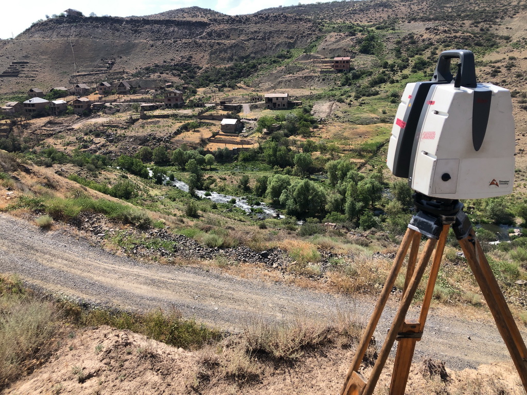
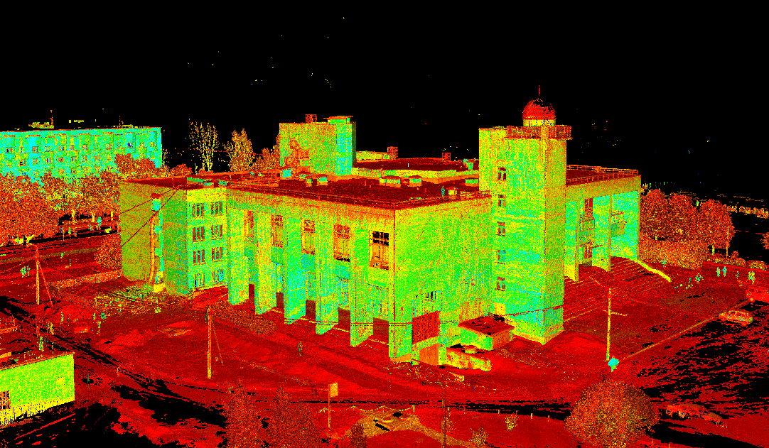
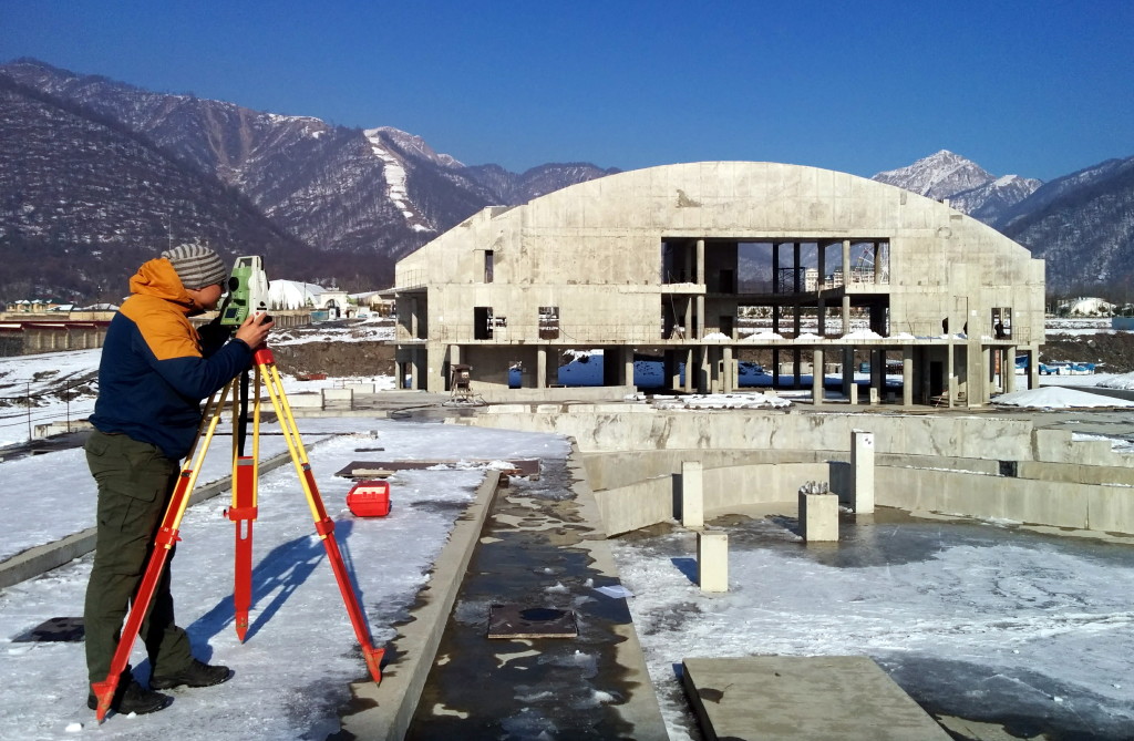
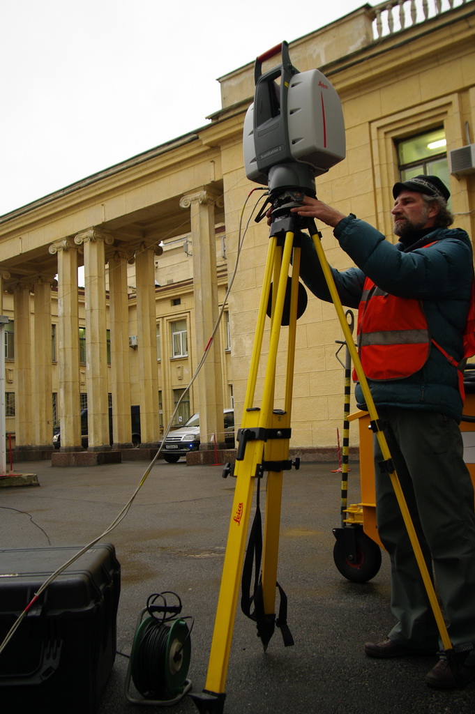
 In July 2022, Trimetari Consulting engineers, commissioned by Gazprom Geotechnology, completed the next cycle of mine surveying and geodetic monitoring of the development of landslide processes in landslide-prone areas of the mining allotment of the Abovyanskaya UGSF using laser scanning systems. The work was carried out in order to ensure industrial safety and protection of subsoil during the operation of the Abovyan underground gas storage station. The specialists obtained quantitative characteristics of the landslide movement in order to identify the growth or attenuation of the landslide process, its modeling and forecasting. The data obtained are also used to develop anti-landslide measures. (read more…)
Projects
Laser scanning of interiors of Tavricheskiy Palace, St. Petersburg, Russia
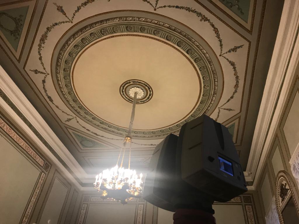 In December 2019, Trimetari Consulting LLC performed a complex of works on laser scanning and office processing in order to obtain initial data for the restoration of the interiors of the Tavricheskiy Palace.
To design the restoration of the offices “Moldova”, “Azerbaijan”, “Armenia”, “Tajikistan” and “Kazakhstan” it was necessary to perform an architectural measurement of the interiors, to obtain detailed information on the geometry of both the premises themselves and the decor, stucco molding, door and window openings, joinery fillings and painting. (read more…)
Laser scanning of Lakhta Center Skyscrapper
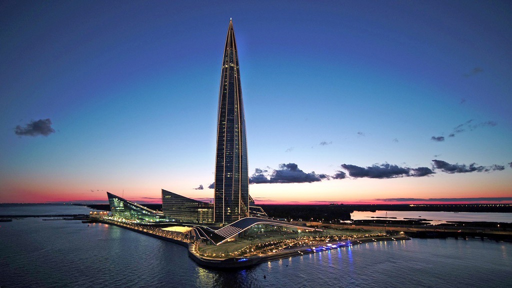
From 2016 to 2019, Trimetari Consulting took part in the project to control the construction of the Lakhta Center building complex, which includes the headquarters of Gazprom PJSC – the tallest skyscraper in Europe. (read more…)
Consulting and Training on Laser Scanning of Gazprojektengineering, Voronezh
 In August 2018, Trimetari Consulting LLC provided consulting services for Gazprojectengineering, the city of Voronezh, Russia. In 2017, the engineering company acquired a Leica ScanStation P30 laser scanner and Leica Cyclone software. Having been trained in laser scanning at a supplier of equipment, the specialists of the engineering survey department of the customer’s company successfully completed a number of first projects. The need for consulting arose due to the need to optimize the production processes associated with laser scanning.
Architecture Measurement of the Art Center for Designing a Rainscreen
 In March 2018 Trimetari Consulting LLC performed a measurement of the building of the Palace of Children’s Youth Creativity named after L.N. Maklakova in Kirishi, Russia by the method of ground-based laser scanning. Built in the Soviet era, in 1984, the Palace survived the nineties, stepped into the 21st century, but for all this time it was practically not updated. That is why the task of repairing the largest education center in Kirishi has become one of the top priorities for the city administration. (read more…)
Laser Scanning and 3D Modeling of the Vyksa Steel Works
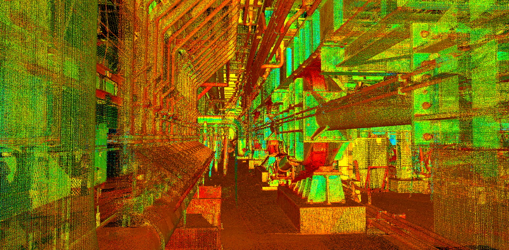 In January 2018, the company Trimetari Consulting LLC carried out work on laser scanning and 3D modeling of the under-furnace space of walking-type furnaces of the Vyksa Steel Works. The aim of the work is to produce a geometric 3D model in the Autodesk DWG file format for further design of the furnace cleaning system. (read more…)
Laser Scanning and BIM-modelling of the Oil Pump Station Salym Petroleum, Tyumen region, Russia
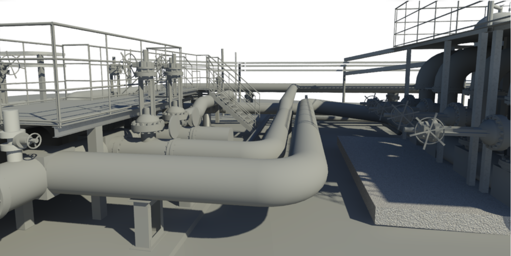 In January 2018 the specialists of Trimetari Consulting LLC performed the work on laser scanning and creation of the BIM-model of the multiphase pumping station located on the territory of the Upper Salym oil field, Khanty-Mansiysk Autonomous District. The history of Salym field, located in the Tyumen region, Russia, began almost 20 years ago with a little development and has reached our days as a major project for oil production. The annual production volume exceeds 6 million tons. (read more…)
BIM-Modeling of The Yuzhnyi Railway Station Using Laser Scanning (Kaliningrad City, Russia)
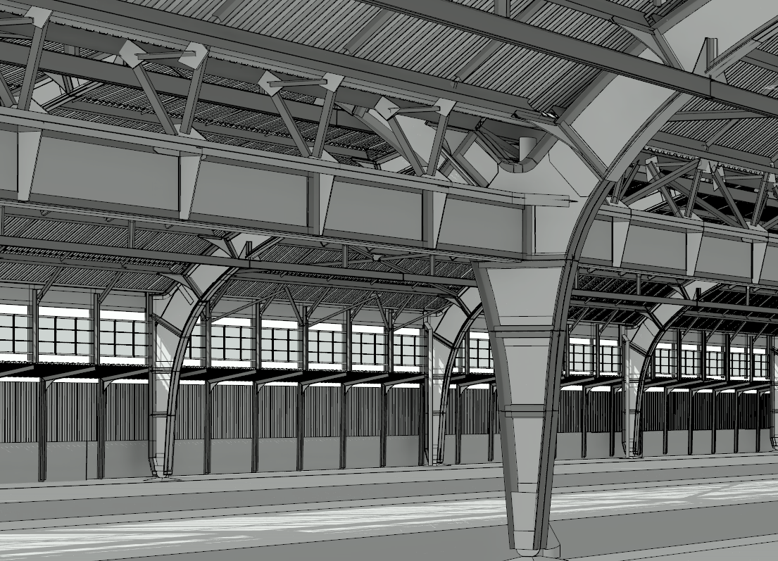 In November 2017, experts of the company Trimetari Consulting LLC completed the work on terrestrial laser scanning and BIM-modeling of the train shed of the Yuzhny Railway Station in Kaliningrad. The work was done with a Leica ScanStation P40 laser scanner in real-color mode. 125 stations (scanner standing points) were executed, the total cloud contains about 16 billion points. As a result of combining the scanner data in a single point cloud, an error of 0.002 m data acquisition was achieved. Based on the results of laser scanning, a BIM model was created in the Autodesk Revit software. (read more…)
Training on Laser Scanning of Tengizchevroil, Kazakhstan
 In November 2017, Trimetari Consulting LLC completed a series of laser scanning courses for employees of Tengizchevroil, Kazakhstan’s largest oil producer. Within the framework of the training, both basic training in working with Leica Geosystems geodetic equipment (Leica ScanStation P40 laser scanner) and Leica Cyclone software was carried out, as well as extended, work-specific Tengizchevroil. The training was conducted at the client’s site, in the Tengiz rotational camp, located at the same oil-and-gas field. (read more…)
As-Built Survey of the Water Park "Diamond Park", Gabala, Azerbaijan
 In January 2017 specialists of Trimetari Consulting LLC handed over to customers an as-built 3D model of Diamond Park – the largest aquapark of Azerbaijan, which is under construction. At the time of the as-built survey, the construction of the concrete monolith was completed, the equipment and part of the communications were installed. Laser scanning was required to analyze the deviations of the actual location of the constructed concrete structures from the design position. Knowledge of the exact dimensions will allow designers to create more qualitatively the load-bearing metal structures of the glass facade and roof. (read more…)
3D Laser Scanning Training of Svarog LLP, Sakhalin
In May 2016, experts of Trimetari Consulting LLC conducted 3D laser scanning training of a group of specialists of Svarog LLP. The training has been provided on the customer’s office in Yuzhno-Sakhalinsk, Russia. The company Svarog several years ago bought a laser scanner Leica ScanStation P20 and software Leica Cyclone. Having passed the standard training course from a supplier of equipment and having received the first experience in laser scanning, Svarog specialists faced the need for further professional development. (read more…)
Topographic Mapping of King Khalid International Airport, Riyadh, Saudi Arabia
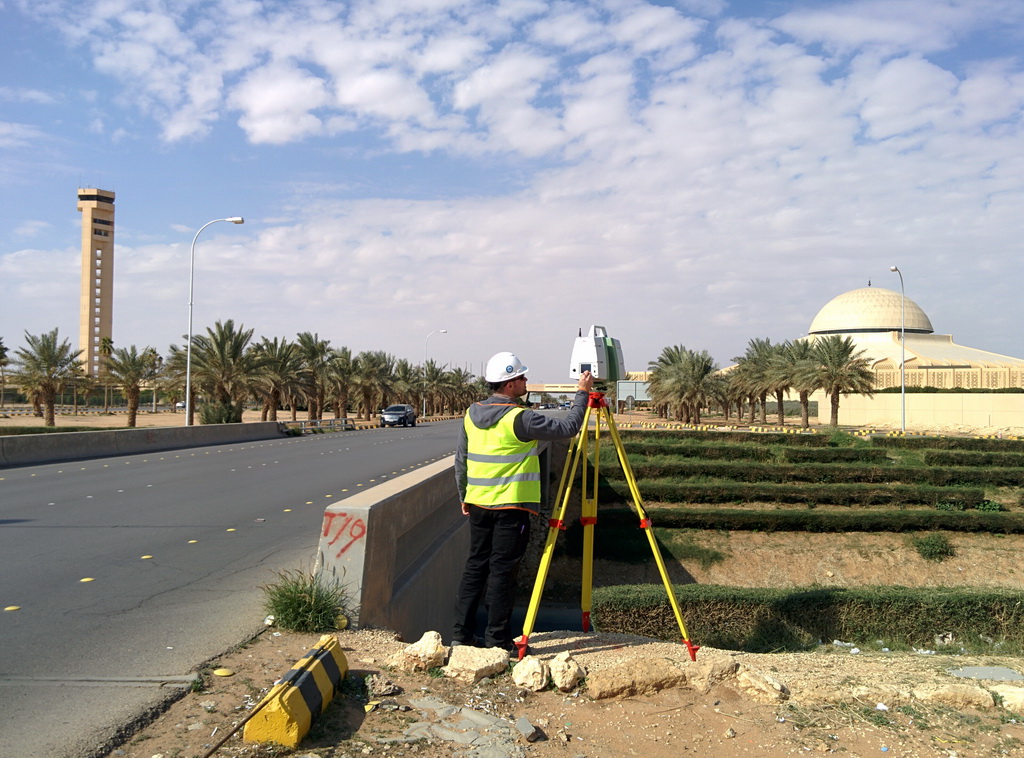 In February 2016, the specialists of the company Trimetari Consulting LLC handed over the latest report materials on the project of the topographic mapping of the King Khalid international airport (Riyadh, Saudi Arabia). Laser scanning of the airport was required for a large-scale reconstruction in connection with a sharp increase in passenger traffic. In 2000, 8 million people used the airport’s services, in 2010 – 13 million, now the air harbor serves more than 25 million passengers a year. (read more…)
Laser Scanning for BIM of Bogoliubovsky Mining Plant, Krasnoyarsk territory, Russia
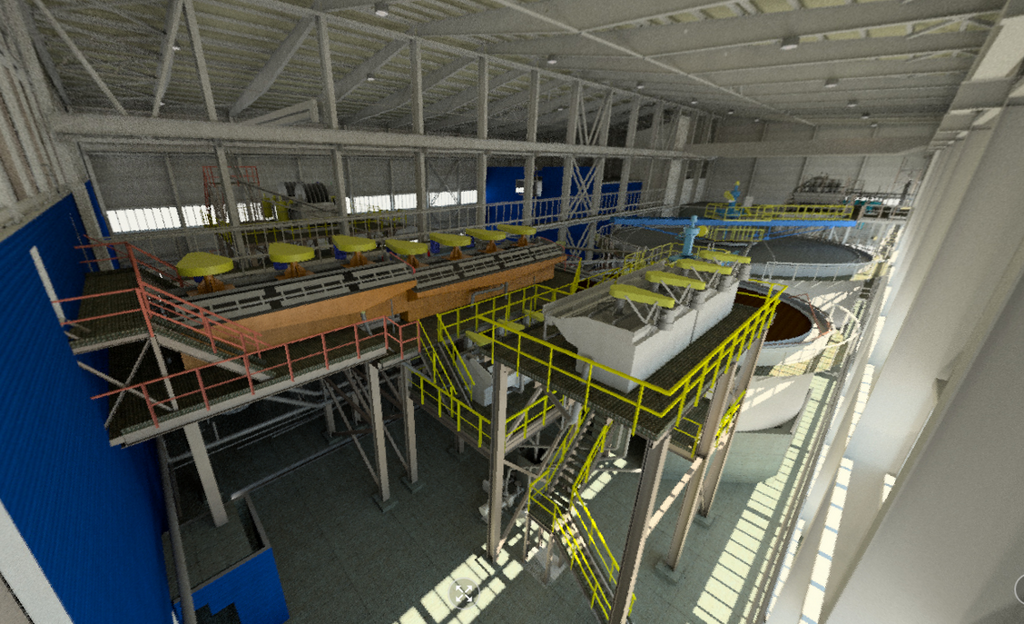 In January 2016, Trimetari Consulting LLC performed laser scanning of the main building of Bogoliubovsky Mining and Processing Plant, which processes gold-sulfide and gold-antimony ore. The purpose of the work is to create an executive BIM-model of the facility. The industrial building with an area of more than 3000 m², multi-level structures, technological equipment and communications were scanned in 2 days. The resulting point cloud was later used to build an accurate and up-to-date BIM model of the factory. (read more…)
Laser Scanning of The Sculpture "The Motherland Calls" on Mamayev Kurgan in Volgograd, Russia
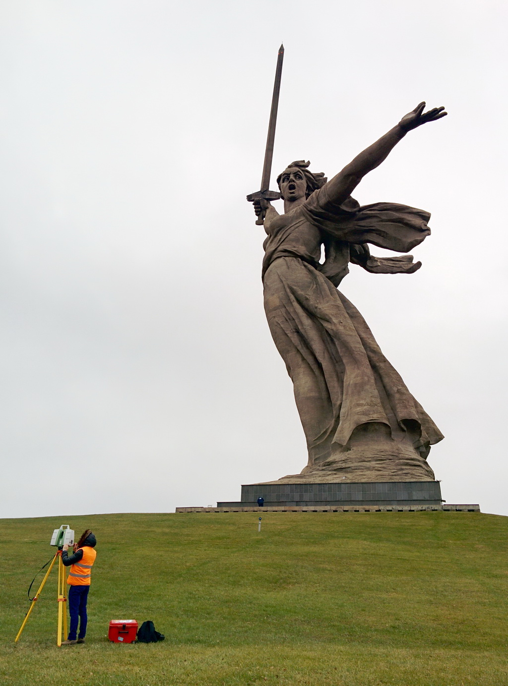 In December 2015, the company Trimetari Consulting LLC performed laser scanning of the world-famous sculpture The Motherland Calls on Mamayev Kurgan in Volgograd, Russia. The statue has a height of 85 m, at the time of its creation it was the highest sculpture in the world. To date, the work of sculptor Yevgeniy Vuchetich and engineer Nikolai Nikitin is the highest statue of Russia and Europe.
The monument built from 1959 to 1967 is the central part of the triptych, which also consists of the sculptures “Rear-Front” in Magnitogorsk and “Warrior-Liberator” in Berlin’s Treptower Park. It is understood that the sword, forged on the bank of the Urals, was later raised by Motherland in Stalingrad and dropped after the Victory in Berlin.
Laser scanning training for Renaissance Construction
In November 2015, employees of the international construction company Renaissance Construction took a laser scanning course at Trimetari Consulting. As a result, the specialists of the geodesy department will not only be able to independently work with their own laser scanners Leica Geosystems, but also effectively deal with the processing of scanned data. (read more…)
Architecture measurement of the St. Mary Magdalene Chapel, Darmstadt, Germany
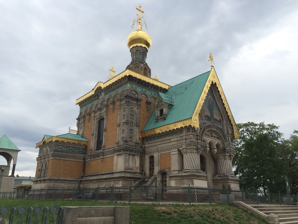 The Church of St. Mary Magdalene is the Orthodox Church in Darmstadt, Germany. The decision to build a church in the land of Hesse was caused by the desire of the last Russian Emperor Nicholas II and Alexandra Feodorovna (nee Princess of Hesse-Darmstadt) to be able to visit the Orthodox church during their stay at the Empress’s homeland. Before the construction the hill was piled up. For this purpose it was brought about 400 wagons of soil collected in different provinces of the Russian Empire. Granite also has been brought to Darmstadt – from the Urals, the Caucasus and from Siberia. Architects determined that the church should be literally from the Russian stone and stand on Russian soil. (read more…)
Measurement of the building using laser scanning to create a BIM model, Petrovsky Boulevard 17, Moscow
 The wine trading house Camill Depre – the building of 1899, built by architect R. Kleim, is located in the center of Moscow on Petrovsky Boulevard. The two-story building has not been used for the past 20 years. On the ground floor there was a wine shop, and in the basement – a shop for bottling wine and wine cellars. The reconstruction of the building was carried out in order to reorganize it to the loft apartment. The measurement of the building by laser scanning was required to quickly create an accurate and up-to-date as-built BIM model. (read more…)
3D Scanning training for St. Petersburg State Polytechnical University
Sorry, this page is available in Russian.
Training on 3D Laser Scanning for «O'zGASHKLITI» Company, Uzbekistan
The staff of land surveying department of «OzGASHKLITI» DUK have been trained on 3D laser scanning by experts of Trimetari Consulting LLC in the customer’s office in Tashkent, Uzbekistan. The name of the course is “Laser Scanner Trimble TX5, Software Trimble SCENE, Trimble RealWorks”. The course includes theoretical foundations of terrestrial laser scanning technology, the field work at customer site, as well as processing of point cloud software package acquired OzGAShKLITI. (read more…)
Laser Scanning Of The Grand Palace at Peterhof
 Sorry, this page is available only in Russian.
3D scanning of the hotel complex for reconstruction using BIM
 In November 2013 the Trimetari Company performed laser scanning of the hotel complex in Moskovskaya Region, Russia. The square of the territory for 3D laser scanning made around 2 ha, on this territory the interiors of all the buildings and constructions, as well as facades, basements and roofing were scanned.
The main problem to be solved with the help of laser scanning and BIM modelling is to provide up to date information on the condition of the whole object for the design of a large-scale reconstruction. The contracting authority used Autodesk Revit Software for the creation of BIM model from the point cloud data. (read more…)
As-built survey of steelworks at Ch. Valikhanova Street in Omsk
 Sorry, this page is available only in Russian.
Training on 3D Laser Scanning using Leica workflow for «Lipetskgeoizyskania» Company
In 2014 Lipetskgeoizyskaniya acquired Leica 3D laser scanner for surveying facades, architectural and industry applications. In January 2015 the company requested Trimetari Consulting to hold a course of terrestrial laser scanning for the staff of Lipetskgeoizyskaniya LLC. (read more…)
Laser scanning for intelligent modeling of Rostov Nuclear Power Plant
 Despite the fact that the first ground-based scanners appeared back in the last century, one can hardly say that a 3D-scanning laser technology is widely used in the design and construction of industrial facilities. The main reasons are probably the cost of such systems which is still high and the lack of information about how to use them effectively in particular applications. Nevertheless, interest in this technology and demand for it on the market of surveying equipment is growing in geometric progression with every year, and the high cost of the acquisition is more and more compensated by the offers from scanning services providers.
Depending on the project goals and objectives, the laser scanning technology can be effectively combined with 3D-design technologies. (read more…)
3D Laser Scanning of the Monument of Vladimir Lenin located on "Ploschad' 1905 Goda" Square in Yekaterinburg
 The main square of Yekaterinburg city, which is called “Ploschad’ 1905 Goda“, had a lot of monuments during its lifitime. Before the revolution, there was the Cathedral on the square, and a monument to Alexander II was established in front of the Cathedral in 1906. In 1918, its place was given to the Statue of Liberty. Then, in 1920, the bust of Karl Marx was installed instead on the same pedestal. A few months later, the Monument to the Liberation of Labor was erected instead of the bust. In 1930, the Cathedral and the monument were blown up. A huge tribune was installed in the center of the square. Finally a monument to Vladimir Lenin was erected on the podium on November 5, 1957. The monument was designed by the sculptor Ingal.
In 2013, the local Ministry of Culture decided to renovate the monument, which is an object of cultural heritage. Trimetari Consulting LLC was awarded a contract to make an architectural survey of the monument by means of 3D laser scanning. (read more…)
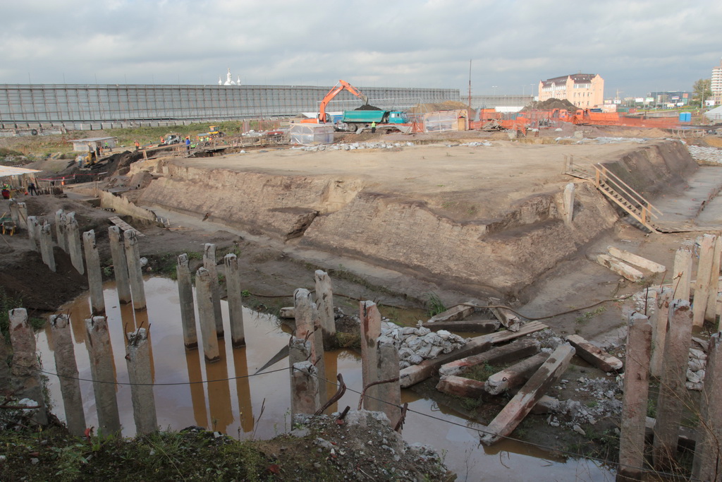
Laser Scanning Of The Copper Ore Quarry In The Middle Urals
 In 2013, Trimetari Consulting LLC in collaboration with The Institute of Mining of the Russian Academy of Science performed surveying of one of the copper ore quarries of UMMC in order to develop a methodology for monitoring geomechanical processes in the open-pit sides. The quarry is located in the Middle Urals, Russia.
The reconnaissance of the career 1000 m long, 600 m wide and 150 m deep was made in order to identify the best locations for the 3D laser scanner stations, as well as their quantity, necessary to bring together all the results of laser scanning into a single coordinate system and obtain a single 3D-model of the open excavation. (read more…)
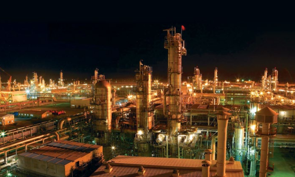
3D Laser Scanning of Southwestern Heat and Power Plant
 In February 2013 Trimetari Consulting LLC performed a geodetic survey of the first power unit of the Southwestern CHP Plant with the use of terrestrial laser scanning . The Southwestern Combined Heat and Power Plant is located in Saint Petersburg, Russia. Laser scanning of existing facilities was carried out in order to create AS-BUILT 3D model for the design of the second stage of the power plant.
(read more…)
Development of a Virtual 3D Model of Denisova Cave in the Altai Mountains for Virtual Environments and Web
 Denisova Cave in the Altai Mountains (Siberia, Russia) is a world famous Paleolithic site (51° 23′ 51.29″ N, 84° 40′ 34.34″ E). Regular archaeological excavations are being performed here since 1982, more than 20 cultural layers were revealed, and more than 80000 finds were collected. In 2008, a new branch in human evolution was discovered based on finds in the Denisova Cave [1]. So it is an actual task to digitally preserve this unique object using up-to-date methods of 3D documentation: i.e. to create virtual (digital) 3D model of the cave and most important finds, and visualize results of archaeological research based on this model. (read more…)
Laser scanning and 3d modeling of Shukhov tower at Shabolovka, Moscow
 Radio tower at Shabоlovka is a symbol of Soviet radio and television broadcasting, a worldwide known monument of architecture which belongs to the Russian avant-garde. Nowadays it’s more often called “the Shukhovskaya Tower” following the name of its creator Vladimir Grigoryevich Shukhov (1853-1939), an outstanding Russian engineer, corresponding member and honored member of the USSR Academy of Sciences. The tower was constructed in 1919-1922, radio broadcasting commenced in May 19, 1922. During 1937-1967 the tower was also used for television broadcasting. (read more…)
Laser scanning of highway tunnels in Sochi
 Trimetari Consulting Company took part in the program on construction and modernization of the transport infrastructure of Sochi, in accordance with the construction of Olympic facilities and development of the city as a mountain resort. Under the contract with the Federal Road Agency in February-March 2012, Trimetari Consulting Company performed operations on 3D laser scanning of the road tunnels on the highways A-149 “Adler – Krasnaya Polyana” and A-147 “Bypass Sochi”.
The total number of the scanned tunnels is 11, all of them are located near Sochi, Russia. The aim of work is filling the electronic database by objective spatial data on the actual condition of tunnel structures at the federal roads. (read more…)
Training for "MurmanskTISIZ" company
Sorry, this page is available only in Russian.
Architectural measurement of the fasades of several buildings at Lenina St in Murmansk
 Sorry, this page is available only in Russian.
Laser scanning of international airport terminal Pulkovo 2
 Sorry, this page is available only in Russian.
Training of laser scanning workflow, organized for OAO "Mostootriad-99"
Sorry, this page is available only in Russian.
Architectural surveys of facades of historical building in a center of Saint-Petersburg (1, Marsovo Pole)
 Sorry, this page is available only in Russian.
3D Laser Scanning of the Church of St. Nicholas the Wonderworker in Ostrov, Pskov Region, Russia
 THE PAGE IS UNDER CONSTRUCTION, SORRY
The Church of St. Nicholas in Zastenie, built from limestone in 1542, is an interesting monument of the Pskov architectural style. The church is located on a small island, washed by the river Velikaya on a both sides. In ancient times there was the fortress, the ruins of which can be found there. The church has a feature, very unusual for orthodox architecture – the altar is placed not to the East but to the North. Presumably northern direction is coincided to the city of Pskov, the founder and patron of his suburban city of Ostrov [1].
In 2012 the restoration of the church was started that required an accurate architectural measurement. (read more…)
Laser Scanning of the underwater roadway tunnel from The Saint Petersburg Flood Prevention Facility Complex
 In May 2011, Trimetari Consulting LLC performed a laser scanning of the Russian underwater tunnel, which is part of St. Petersburg Flood Protection Barrier (FPB). The construction of the unique hydraulic structure including eleven dams, six culverts, two navigation openings and six-lane highway that runs along the crest of the dams and makes out 25 km with bridges, tunnels and interchanges, was launched in 1979. In August 2011, the FPB was put in commission. The tunnel is considered to be the longest underwater tunnel in Russia. (read more…)
Laser scanning of a road in Saint-Petersburg for design and construction using machine control systems
 Sorry, this page is available only in Russian.
Laser scanning of the open sandpit for volume calculation
 On request of a private investor in April 2011, Trimetari Consulting LLC performed a laser scanning of a sand pit in the Tver Region, Russia. The purpose of the work is a calculation of the volume of sand, available for open cast mining and, as a consequence, the estimation of the profitability of the sand pit. (read more…)
Rescue archaeological excavations at Cape Okhta in Saint Petersburg
 In summer and autumn 2010 specialists of “Trimetari Consulting” have supported a project of scanning of archaeological excavations at Cape Okhta in Saint Petersburg. Historical significance of this area was firstly noticed already in the 90s of the last century, but serious studies started in 2006 by research institute “Nasledie”. The unique historical objects have been found, such as a number of Neolithic sites, remains of the fortifications of Landscrona and Nyenschantz, XIV and XVII century respectively. (read more…)
Topographical Survey of Irganaiskaya Hydroelectric Power Plant by 3D Laser Scanning

In February and March 2012 Trimetari Consulting performed engineering survey by 3D laser scanning of the rocky slope that is placed above the intake channel and the appurtenance of Irganaiskaya hydroelectric power plant, Dagestan region, Russia. Due to needs of the customer, RusHydro corporation, the work was carried out to obtain topographic maps of scale 1:500 and a three-dimensional terrain model. The 3D-model should be suitable for further detailed engineering geological zoning of the slope, as well as to ensure the design work of rockfall protection. (read more…)
Share this page: