 Technological monuments are vulnerable to decay. 3D modelling and documentation are essential to avoid them falling into irreparable decline and to enable future restoration. Terrestrial laser scanning (TLS) is a proven technology for capturing complex objects. Read about the TLS capture of two iconic technological monuments in Russia: the Motherland Calls statue and the Aurora cruiser.
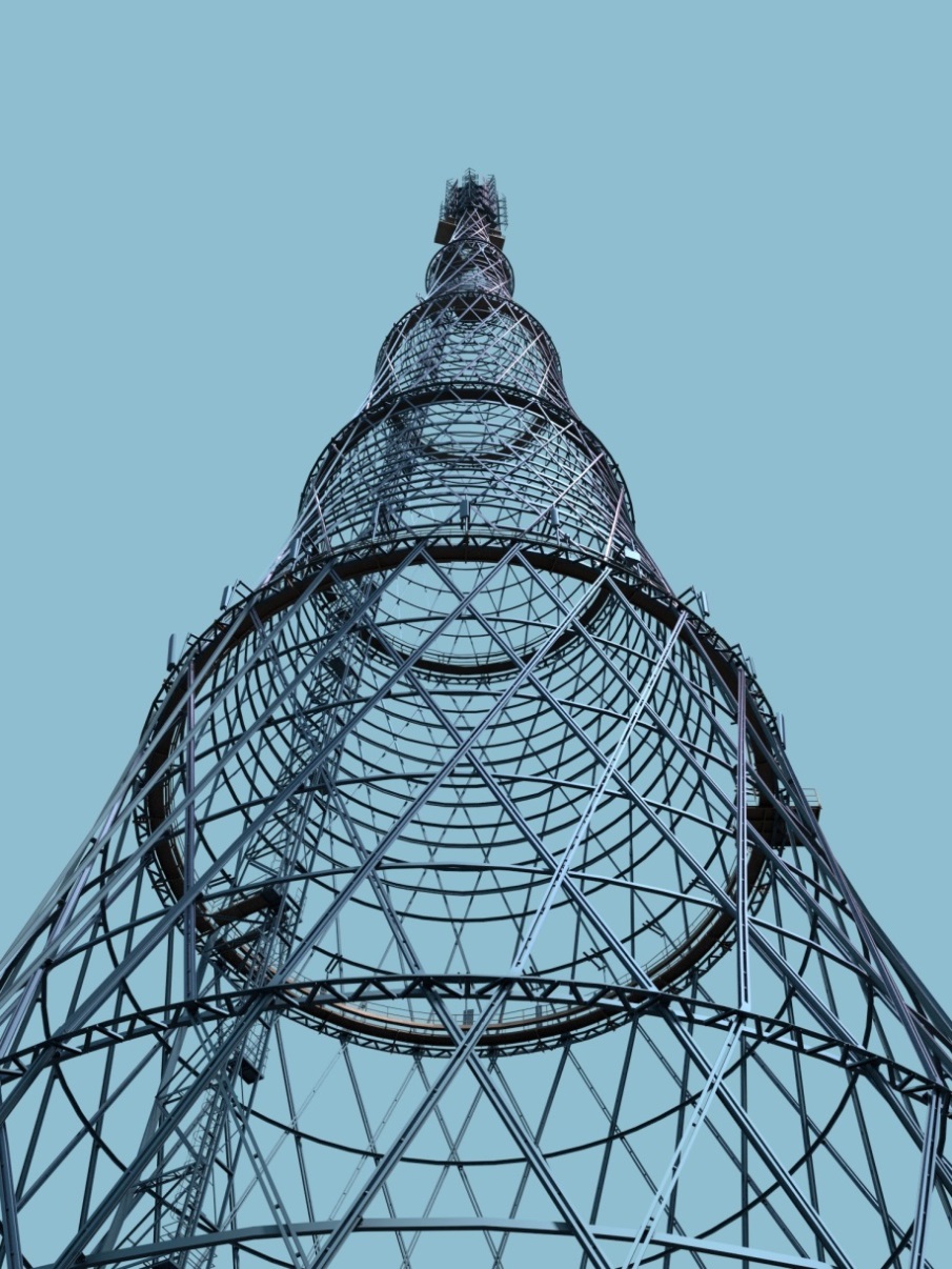
Technological monuments are more vulnerable to decline than paintings or manuscripts, since they are located outdoors and exposed to rain, temperature variations and other weather elements. They also often suffer from overdue maintenance due to a lack of funding as commercial exploitation is complicated. Technological monuments and other historical objects also often suffer from a lack of existing documentation, particularly because many of them have undergone numerous – and often unrecorded – changes since being built in the Soviet era. One example of this is the Shukhov tower, which was discussed in the July 2014 edition of GIM International. This article focuses on two other technological monuments.
The Aurora cruiser is one of the symbols of the Russian Revolution, the centenary of which will be marked in 2017. Today, Aurora is preserved as a technological monument and naval museum and moored in St. Petersburg. Meanwhile, the ‘Motherland Calls’ statue in Volgograd will be celebrating its 50th anniversary in 2017. 3D modelling and documentation are essential to ensure the preservation of both these iconic heritage landmarks.
Laser scanning in Russia
 Since the early 2000s, the Russian economic recovery has propelled projects to improve the infrastructure and boosted many industrial developments, including the construction of nuclear power plants, expansion of mining activities, oil and gas production and building of pipelines and oil refineries. 3D documentation is required in the design, (re)construction and monitoring of such objects and terrestrial laser scanning (TLS) has become established as the optimal method for capturing the objects as the basis for such documentation. This technique can also be applied to model technological monuments.
The Motherland calls
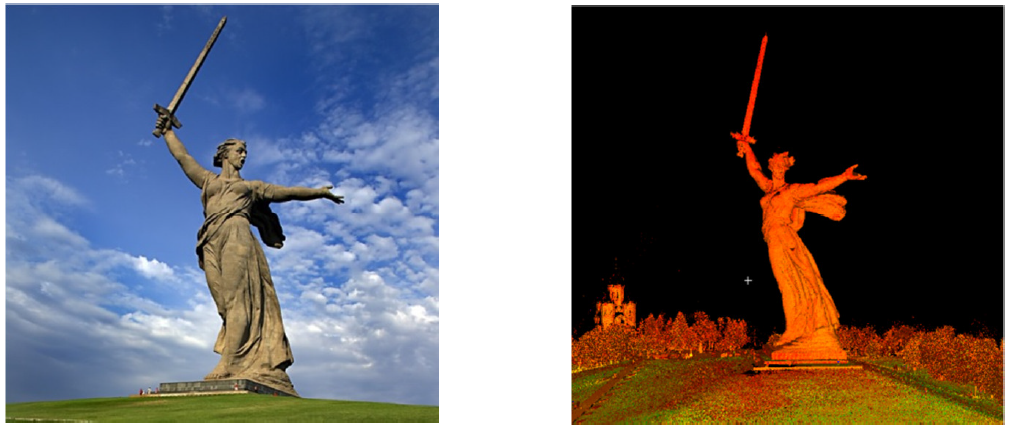
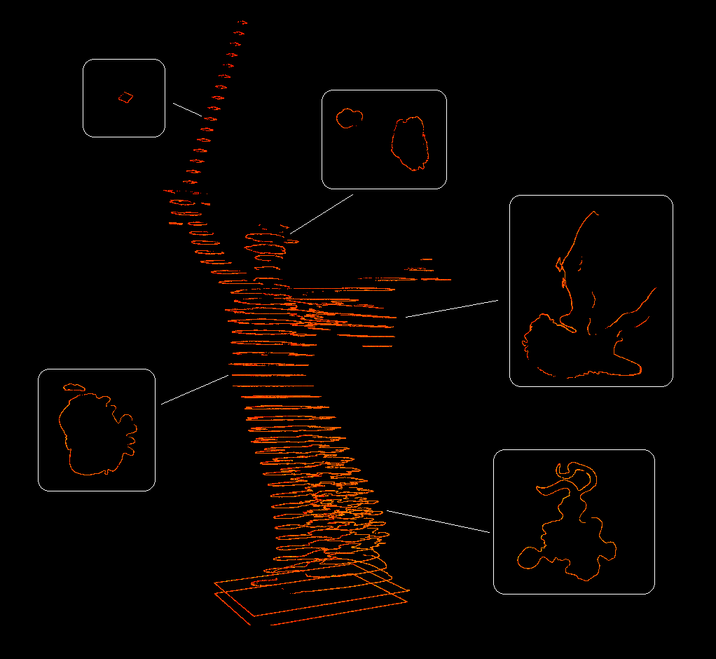
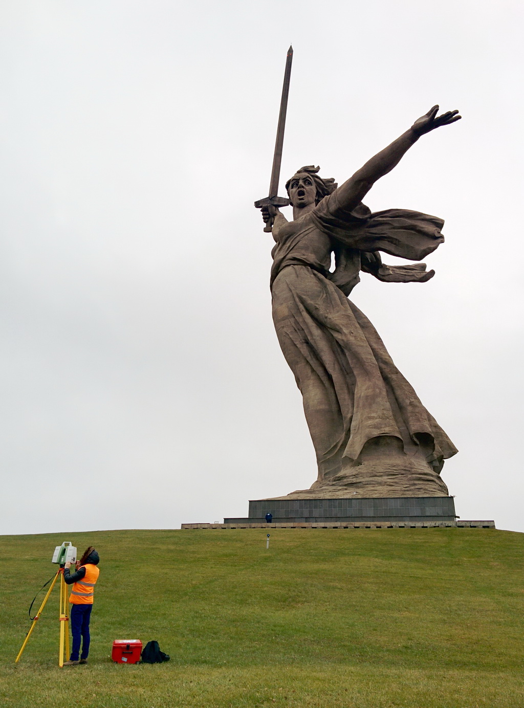 With a height of 85m from its base to the tip of the sword, the Motherland Calls statue in Volgograd city (formerly Stalingrad) is one of the tallest sculptures in the world (Figure 1). The steel sword measures 33 metres. The statue memorialises the Battle of Stalingrad which, with over two million casualties, was one of history’s bloodiest-ever battles. It stands on the site where, in 1942-1943, the encroaching Nazi army was brought to a halt, resulting in a decisive reversal in World War II. The robust construction of the statue is thanks to steel cables inside the hollow structure to shore up the thin walls, which are made of prestressed concrete. The statue was designed by Nikolay Nikitin (1907-1973) who also designed the extremely tall Ostankino TV tower in Moscow. Both the statue and the tower stand on a plinth and are held in place by their own weight.
The statue was scanned using the Leica ScanStation C10. The maximum range of 300 metres enabled the scanning of foreground, plinth, torso and head (Figure 2). The scanning, performed from 6-7 December 2015 by two engineers, took four man-days. 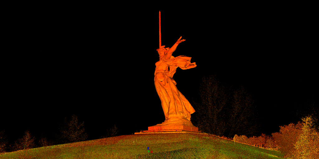 The 11 scans were taken from a distance of 30-140 metres, resulting in a point spacing of 1-3cm for the body of the statue, 12-17cm for the head and 20-25cm for the sword. These relatively low point densities were defined by the customer – the Dream Laser company – who primarily focused on visualisation which did not require high levels of detail. However, the same survey layout would enable the capture of highly detailed point clouds which may be useful for monitoring decay and seasonal or permanent deformations, for example. The scans were aligned using Leica HDS black and white targets with a mean alignment error of 5mm.
Scanning the Aurora cruiser
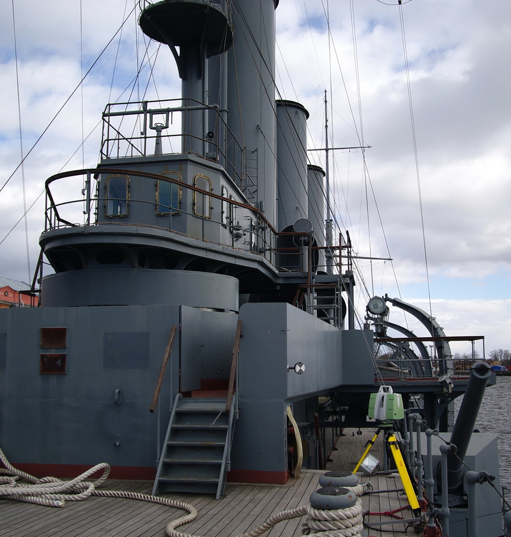
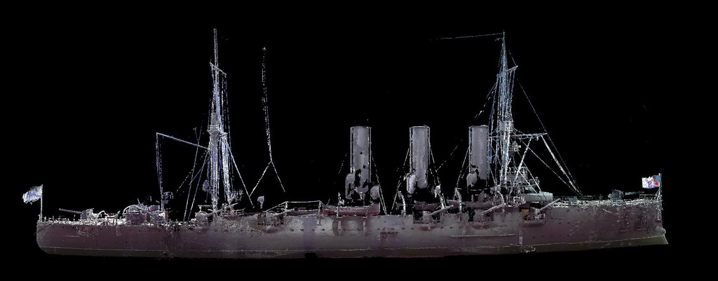
 Operational since 1903, Aurora took part in the Russo-Japanese War (Figure 3). The protected cruiser is particularly famous because of its symbolic role in the October Socialist Revolution; on 25 October 1917 it fired the shot signalling the start of the assault on the Winter Palace. It later became a training ship and since 1957 it has been a memorial ship, permanently moored in the Neva River in St. Petersburg. With its engine room and exhibition, it is a major tourist attraction. Six rooms are currently in use as a museum and four more rooms are being prepared for future display.
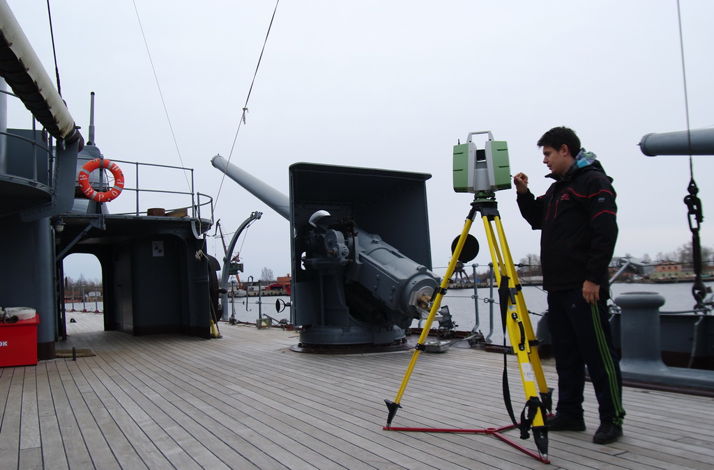
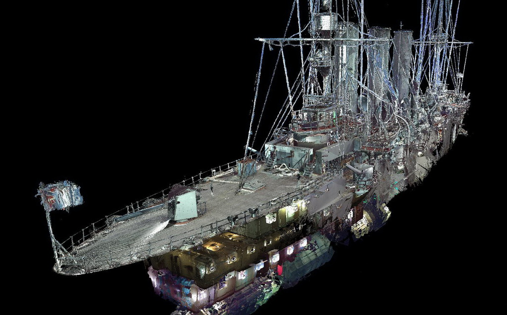
 Large-scale restoration of the cruiser – length: 126.8m; width 16.8m – started in 2014. The curved walls and complex shape of the interior were the main reason for choosing TLS. Using a Leica ScanStation P20 and a FARO Focus3D Multisensor, the scanning was conducted from 6-10 April 2015 and took ten man-days. Having a maximum range of 120m, the P20 was well-suited to scan the upper deck (Figure 4), the command bridge and long corridors. To register the 74 scans (2.8 billion points in total) Leica HDS black and white targets (rotating) along with paper targets were mounted in the overlaps of the scans. Over 200 targets were distributed throughout the ship for this purpose.
 FARO Focus3D Multisensor was used simultaneously to scan parts of the upper deck, rooms, narrow corridors and ladders. The compact and lightweight scanner made it possible to capture the confined spaces effectively. At distances greater than approximately 40 metres the Focus 3D data seemed to be of a lower quality than the data captured by the P20, with the P20 data appearing to be more stable. It is intended to align the point cloud created from the 125 Focus3D scans with the ‘skeleton point cloud’ generated from the P20.
 Modelling and results
The polygonal modelling of ten rooms with a total volume of 2,140m3 was carried out using Blender3D software and took around 45 man-days (Figure 5). Another company utilised the 3D model to prepare for an exhibition, using Autodesk 3DS Max to texture the 3D models and to design the exhibition, the light plan and decorations (Figure 6).
The ship’s motion caused the compensators of the scanners to go out of range, resulting in a relatively low accuracy of the registration of the P20 scans, which did not exceed the level of several centimetres. Some smaller parts could not be modelled because of their complex shapes. Attempts to improve the accuracy by measuring the targets with a Sokkia total station failed because the compensator of that instrument also went out of range.
Concluding remarks
 At present around 70% of the Aurora cruiser has been scanned, including 40% of the exterior. Full scanning of the hull requires the ship to be moved to a dry dock. Capturing additional data could improve the accuracy of registration and enable creation of a complete model of the ship. Negotiations with the Ministry of Defence are underway to continue 3D modelling of the Aurora. It would be advantageous to set up an international fund, such as has been done with CyArc or Scottish Ten, aimed at scanning Russian industrial heritage. Unfortunately, organisations in the West seem reluctant to accept, archive and publish 3D survey data from Russia, even though this would also benefit European heritage preservation.
The article by Andrey Leonov and Mikhail Anikushkin (Russia) initially has been published at GIM International Magazine 09.08.2016