 In July 2022, Trimetari Consulting engineers, commissioned by Gazprom Geotechnology, completed the next cycle of mine surveying and geodetic monitoring of the development of landslide processes in landslide-prone areas of the mining allotment of the Abovyanskaya UGSF using laser scanning systems. The work was carried out in order to ensure industrial safety and protection of subsoil during the operation of the Abovyan underground gas storage station. The specialists obtained quantitative characteristics of the landslide movement in order to identify the growth or attenuation of the landslide process, its modeling and forecasting. The data obtained are also used to develop anti-landslide measures.
 The Abovyan underground gas storage is part of the gas transportation system of Armenia. The UGS facility was built in rock salt deposits at a depth of about 750-1050 m. The Abovyan station is designed to equalize the annual (seasonal) uneven gas consumption in the Republic of Armenia, as well as to provide consumers with natural gas in case of gas supply restrictions. It is an object of strategic importance. The operator of the Armenian gas transmission system is Gazprom Armenia, a subsidiary of Gazprom.
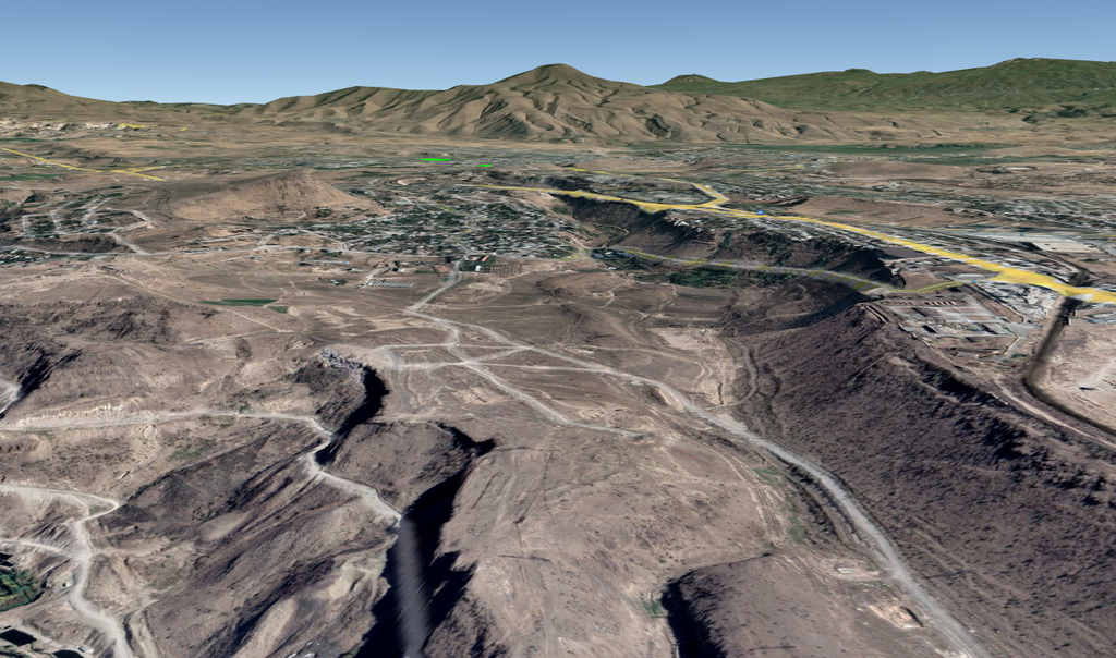
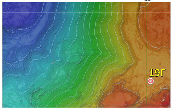
 The objects of observation are well pads, engineering and technical communications and slopes located in potentially dangerous areas of development of landslide processes, as well as sections of the ways of the underground diversion channel of the Kanaker hydroelectric power station and the Arzni-2 water line supplying drinking water to the northern regions of Yerevan.
The Baltic height system was used as the initial one in the work area, as well as the UTM-38N system were taken as the coordinate system. UTM-38N is the initial one during GNSS observations and error-free transformations to other coordinate systems.
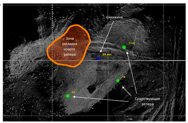
 To register the scan data to the local coordinate system, the method of installing a laser scanner over a known point was used. GUGK points were used as a network point. During the reconnaissance of the 1st cycle of observations, the lost network points were identified, as well as those that had become unusable during operation, at some of the points the initial coordinates do not correspond to the real position. Based on the results of the network analysis, recommendations were issued for restoring lost network points and updating coordinates.
 The main requirements were quantitative indicators (at least 4 network points per well) and criteria for placing points on the ground. The most favorable place for laying is the outcrop of bedrock, as well as an elevated form of relief with coarse-grained and sandy, slightly moistened soil, with deep groundwater.
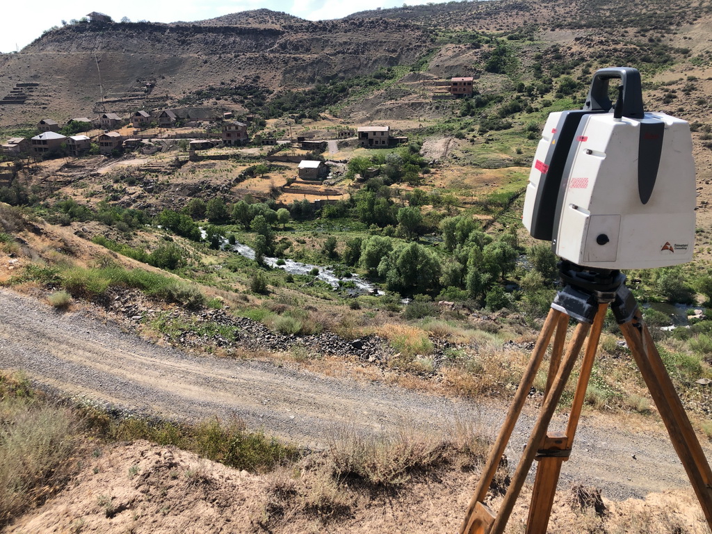
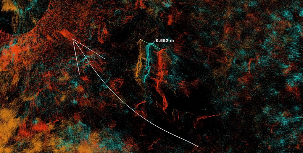
 At the field stage, Trimetari Consulting specialists tried to collect the maximum amount of data reflecting the exact geometry of the object. Laser scanning was carried out with a Leica ScanStation P40 scanner. Field work lasted 4 days, during which time an area of 1.4 km² of mountainous terrain was scanned. For mutual adjustment, standard Leica targets for laser scanning on a magnetic mount were used.
The office processing of laser scanning data consisted of the following steps:
- Georeferencing of survey data to determine the exact position of alleged defects in the local coordinate system.
- Formation of an actual digital elevation model (DEM) based on the data obtained.
- Recording of all changes that have occurred on the object during the current cycle (survey frequency – 1 time per year, the first cycle was carried out in 2020).
- Comparison of data obtained for different cycles.
- Identification of changes that have occurred on the territory of the object.
- Prediction of a further scenario for the development of landslide processes.
- Analysis of DEM slopes.
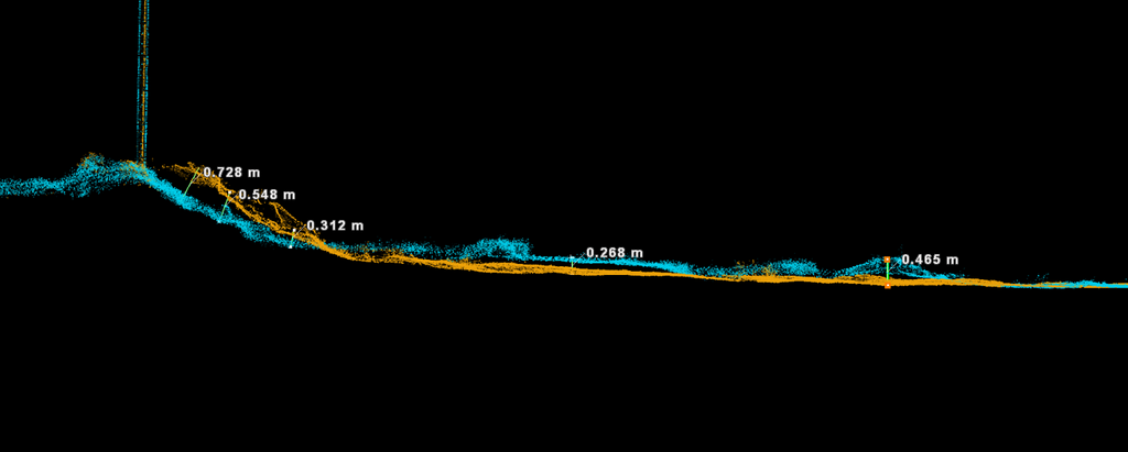 Based on the results of the monitoring work, a 230-page report was compiled, including a description of the measurement methodology, as well as all the results presented in graphical and tabular forms. Ivan Alekseenko, project manager at Trimetari Consulting, noted that “the laser scanning method allows obtaining much more information about the movement of a landslide body, which, compared to traditional point measurements, provides an opportunity for a comprehensive analysis of geometry changes over time.” Alexander Solopov, an engineer of Hexagon Geosystems, who took part in the project, gave an unambiguously positive assessment of the monitoring techniques used and pointed out to the customer “the need to maintain the geodetic network in a form suitable for operation, since the accuracy of laser scanning directly depends on the quality of the geodetic network.”
 LLC “Gazprom geotechnologies” is engaged in the development of technologies and technical means for the construction and operation of underground storage facilities for gas, oil and products of their processing. The company performs design, expertise, geological and hydrogeological studies, develops programs for calculating the stable shapes and sizes of underground reservoirs, and also provides other services related to the design, construction, operation of underground storage facilities, and conducts scientific research. In total, about 100 underground reservoirs for storing liquid and gaseous hydrocarbons have been built and operated using technologies developed by Gazprom Geotechnologies.
Works on mine surveying and geodetic monitoring using laser scanning – the profile of Trimetari Consulting. The wide experience of such work, the qualifications of employees and the technical level of the equipment used allows us to perform work of any complexity. Part of the work performed on laser scanning in topography, mine surveying is published in the Projects section.