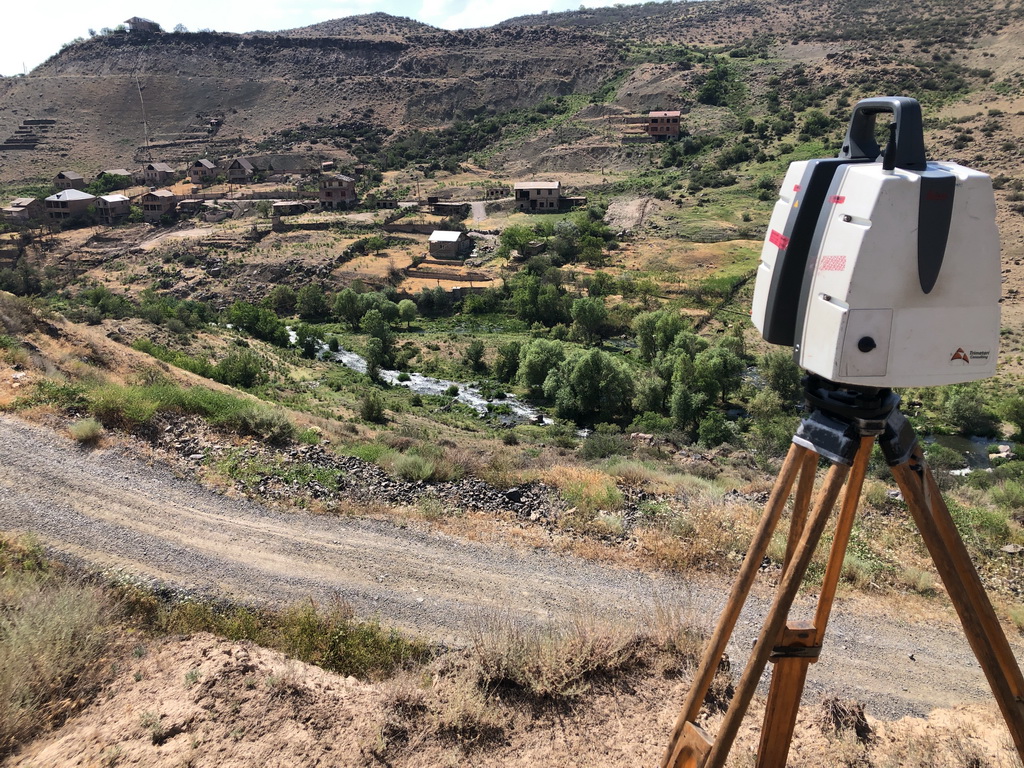
 In July 2022, Trimetari Consulting engineers, commissioned by Gazprom Geotechnology, completed the next cycle of mine surveying and geodetic monitoring of the development of landslide processes in landslide-prone areas of the mining allotment of the Abovyanskaya UGSF using laser scanning systems. The work was carried out in order to ensure industrial safety and protection of subsoil during the operation of the Abovyan underground gas storage station. The specialists obtained quantitative characteristics of the landslide movement in order to identify the growth or attenuation of the landslide process, its modeling and forecasting. The data obtained are also used to develop anti-landslide measures. (read more…)
Geodesy
Architecture Measurement of the Art Center for Designing a Rainscreen
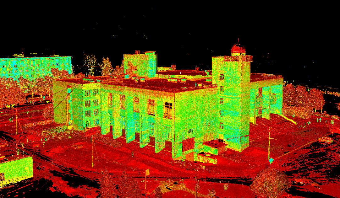 In March 2018 Trimetari Consulting LLC performed a measurement of the building of the Palace of Children’s Youth Creativity named after L.N. Maklakova in Kirishi, Russia by the method of ground-based laser scanning. Built in the Soviet era, in 1984, the Palace survived the nineties, stepped into the 21st century, but for all this time it was practically not updated. That is why the task of repairing the largest education center in Kirishi has become one of the top priorities for the city administration. (read more…)
Topographic Mapping of King Khalid International Airport, Riyadh, Saudi Arabia
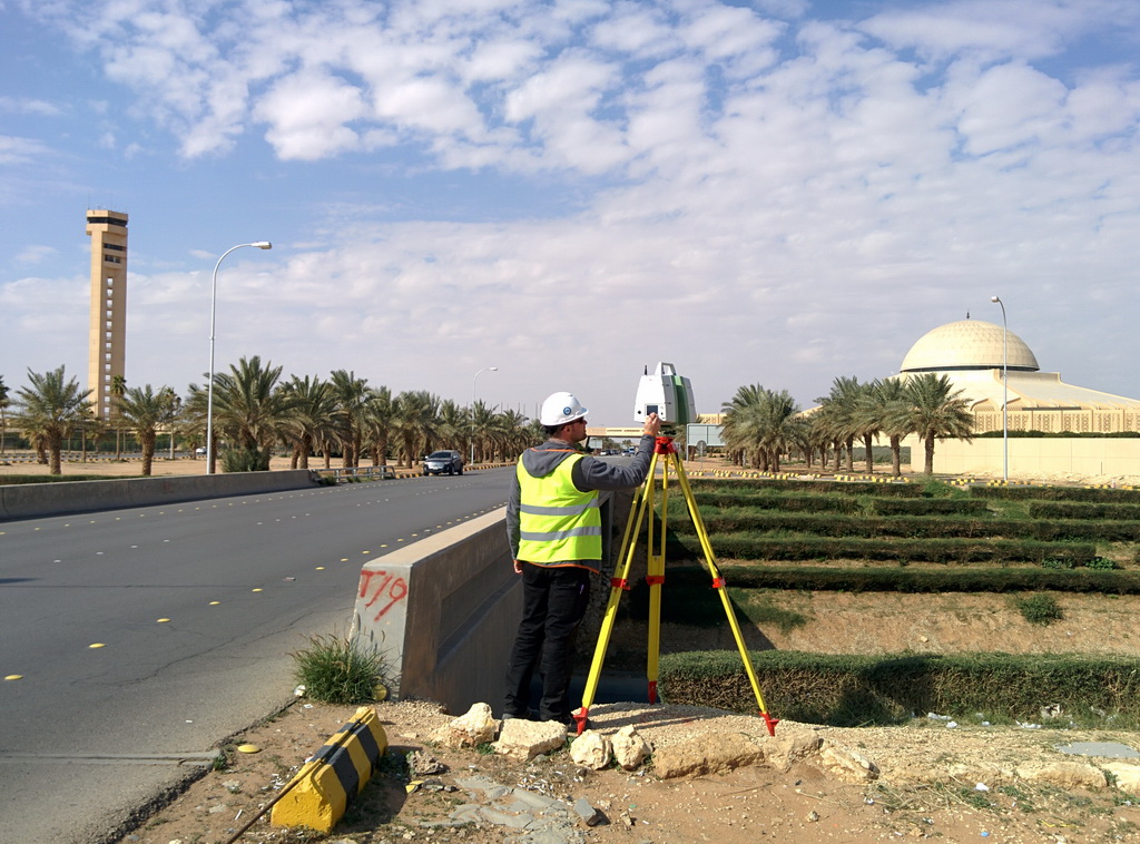 In February 2016, the specialists of the company Trimetari Consulting LLC handed over the latest report materials on the project of the topographic mapping of the King Khalid international airport (Riyadh, Saudi Arabia). Laser scanning of the airport was required for a large-scale reconstruction in connection with a sharp increase in passenger traffic. In 2000, 8 million people used the airport’s services, in 2010 – 13 million, now the air harbor serves more than 25 million passengers a year. (read more…)
As-built survey of steelworks at Ch. Valikhanova Street in Omsk
 Sorry, this page is available only in Russian.
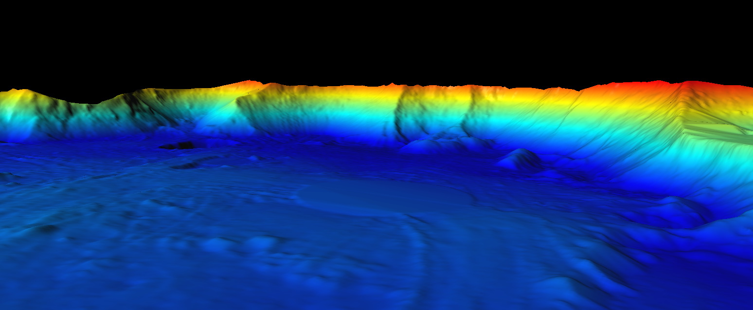
Laser Scanning Of The Copper Ore Quarry In The Middle Urals
 In 2013, Trimetari Consulting LLC in collaboration with The Institute of Mining of the Russian Academy of Science performed surveying of one of the copper ore quarries of UMMC in order to develop a methodology for monitoring geomechanical processes in the open-pit sides. The quarry is located in the Middle Urals, Russia.
The reconnaissance of the career 1000 m long, 600 m wide and 150 m deep was made in order to identify the best locations for the 3D laser scanner stations, as well as their quantity, necessary to bring together all the results of laser scanning into a single coordinate system and obtain a single 3D-model of the open excavation. (read more…)
Development of a Virtual 3D Model of Denisova Cave in the Altai Mountains for Virtual Environments and Web
 Denisova Cave in the Altai Mountains (Siberia, Russia) is a world famous Paleolithic site (51° 23′ 51.29″ N, 84° 40′ 34.34″ E). Regular archaeological excavations are being performed here since 1982, more than 20 cultural layers were revealed, and more than 80000 finds were collected. In 2008, a new branch in human evolution was discovered based on finds in the Denisova Cave [1]. So it is an actual task to digitally preserve this unique object using up-to-date methods of 3D documentation: i.e. to create virtual (digital) 3D model of the cave and most important finds, and visualize results of archaeological research based on this model. (read more…)
Laser scanning of the open sandpit for volume calculation
 On request of a private investor in April 2011, Trimetari Consulting LLC performed a laser scanning of a sand pit in the Tver Region, Russia. The purpose of the work is a calculation of the volume of sand, available for open cast mining and, as a consequence, the estimation of the profitability of the sand pit. (read more…)
Topographical Survey of Irganaiskaya Hydroelectric Power Plant by 3D Laser Scanning
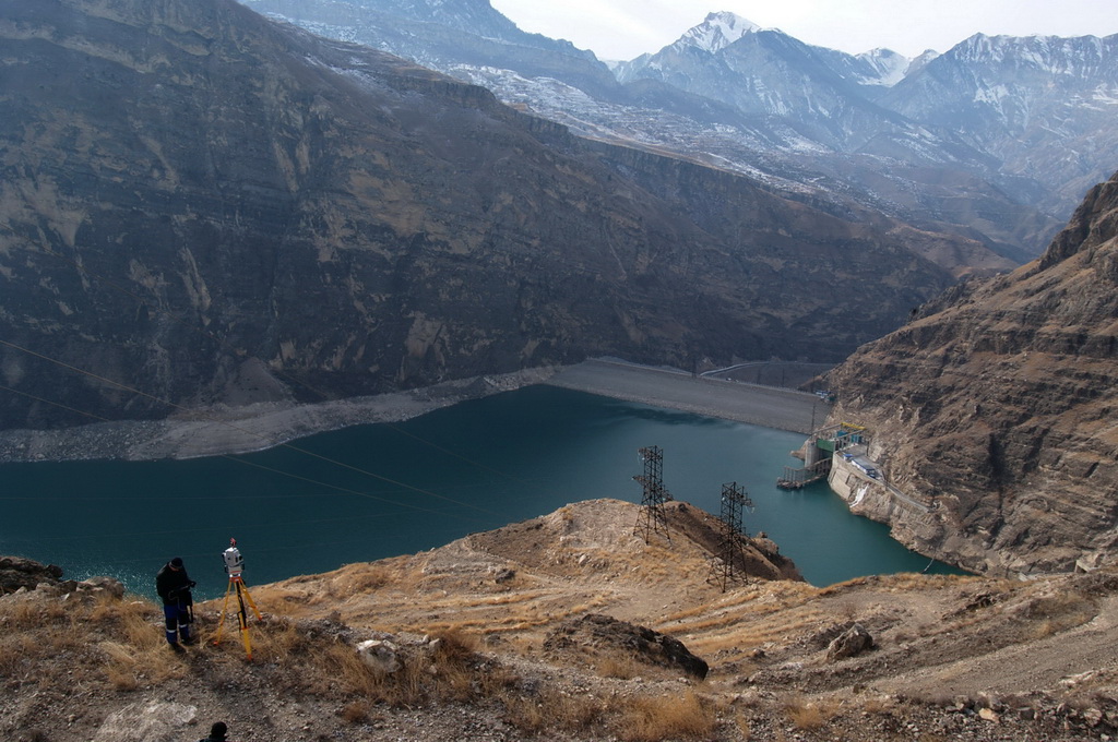
In February and March 2012 Trimetari Consulting performed engineering survey by 3D laser scanning of the rocky slope that is placed above the intake channel and the appurtenance of Irganaiskaya hydroelectric power plant, Dagestan region, Russia. Due to needs of the customer, RusHydro corporation, the work was carried out to obtain topographic maps of scale 1:500 and a three-dimensional terrain model. The 3D-model should be suitable for further detailed engineering geological zoning of the slope, as well as to ensure the design work of rockfall protection. (read more…)
Share this page: