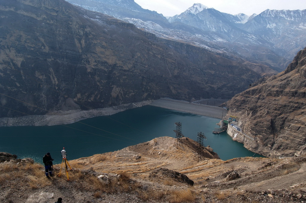
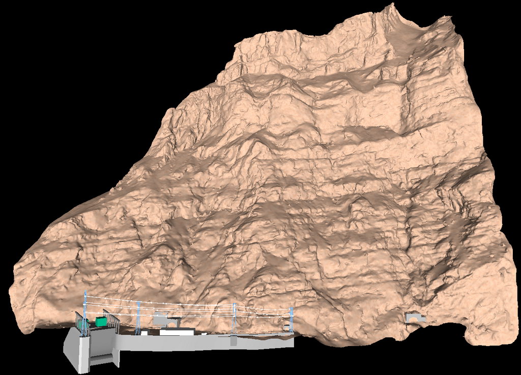
In February and March 2012 Trimetari Consulting performed engineering survey by 3D laser scanning of the rocky slope that is placed above the intake channel and the appurtenance of Irganaiskaya hydroelectric power plant, Dagestan region, Russia. Due to needs of the customer, RusHydro corporation, the work was carried out to obtain topographic maps of scale 1:500 and a three-dimensional terrain model. The 3D-model should be suitable for further detailed engineering geological zoning of the slope, as well as to ensure the design work of rockfall protection.
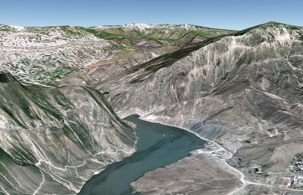
The study area is located in the central part of Dagestan on the river Avar Koisu. The relief of the area is of midland type, strongly dissected with very steep slopes. Some slopes of the valley are covered by thorns. Work on laser scanning were performed in winter, an unfavorable for land survey period that is starts on October 10 and ends on April 25.
The existing surveying network has been used to perform georeferencing of scan stations. The works were carried out on three stages:
– Reconnaissance,
– Field work,
– Office survey.
The survey crew made reconnaissance in one day. They detected best positions for laser scanner and for points of temporary survey network and created a schedule of the field work.
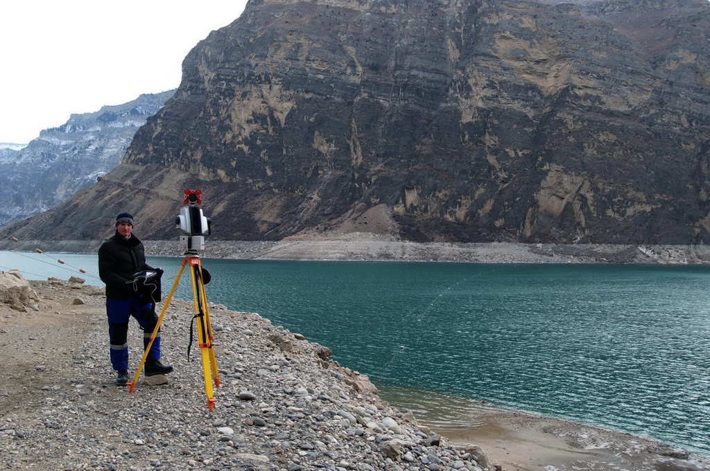
The field work has been done with use of 3D laser scanner Leica HDS8800. This model has been choosed due to it’s technical features. The most important are 2 kilometers range and the perfect ingress protection IP64, the georeferencing method is also very useful. Moreover, the temperature range is critical because of conditions of Russian winter, that can make the field work impossible even in Dagestan – the southest region of Russia. HDS8800 is the only 3D scanner capable of operating at -40°C. A laser scanner is controlled by an operator, the measurement process is rather automated, eliminating human error. There were made 6 stations total, the distance between stations is vary from 300 to 900 meters.
For georeferencing point clouds from different stations the method of “known point” has been used. The scanner has been placed over a point with known coordinates and oriented to another point from surveying network. If the scanner has not been installed over the known point, the total station Sokkia SET 230RK3 has been used to measure the position of the 3D scanner. To do this there is a possibility to put a prism reflector on the top of the laser scanner.
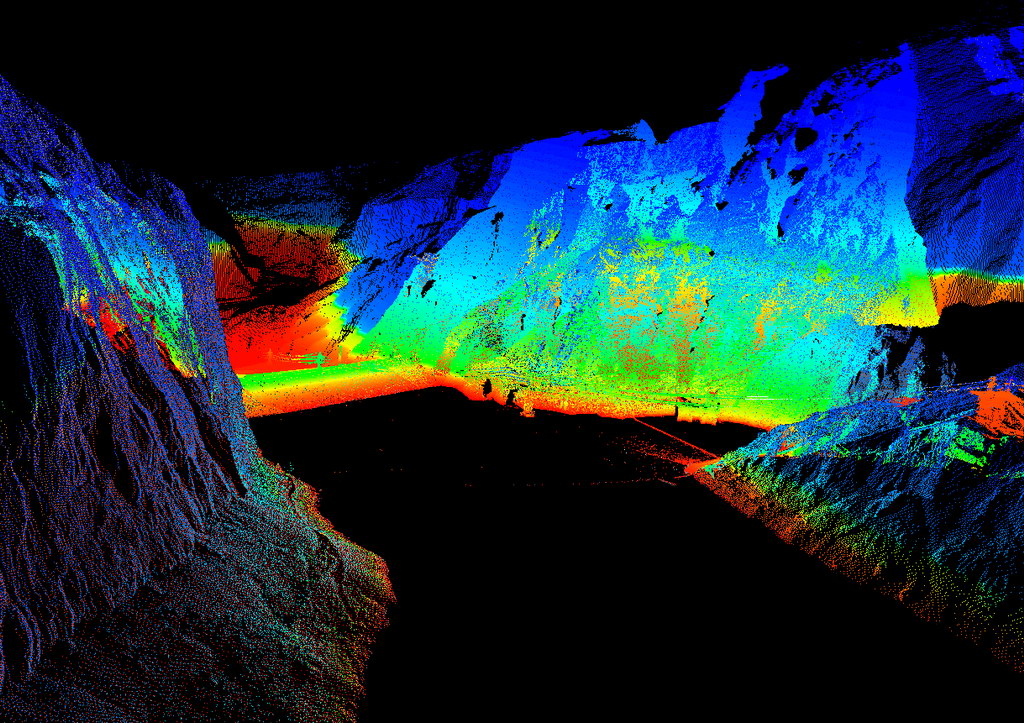
The result of laser scanning – a point cloud – has been obtained in 3 days.
The processing of the point cloud were carried out in 3 stages:
– filtering and segmenting of the point cloud,
– creation of DTM and 3D-model of parts of the intake channel and the appurtenance,
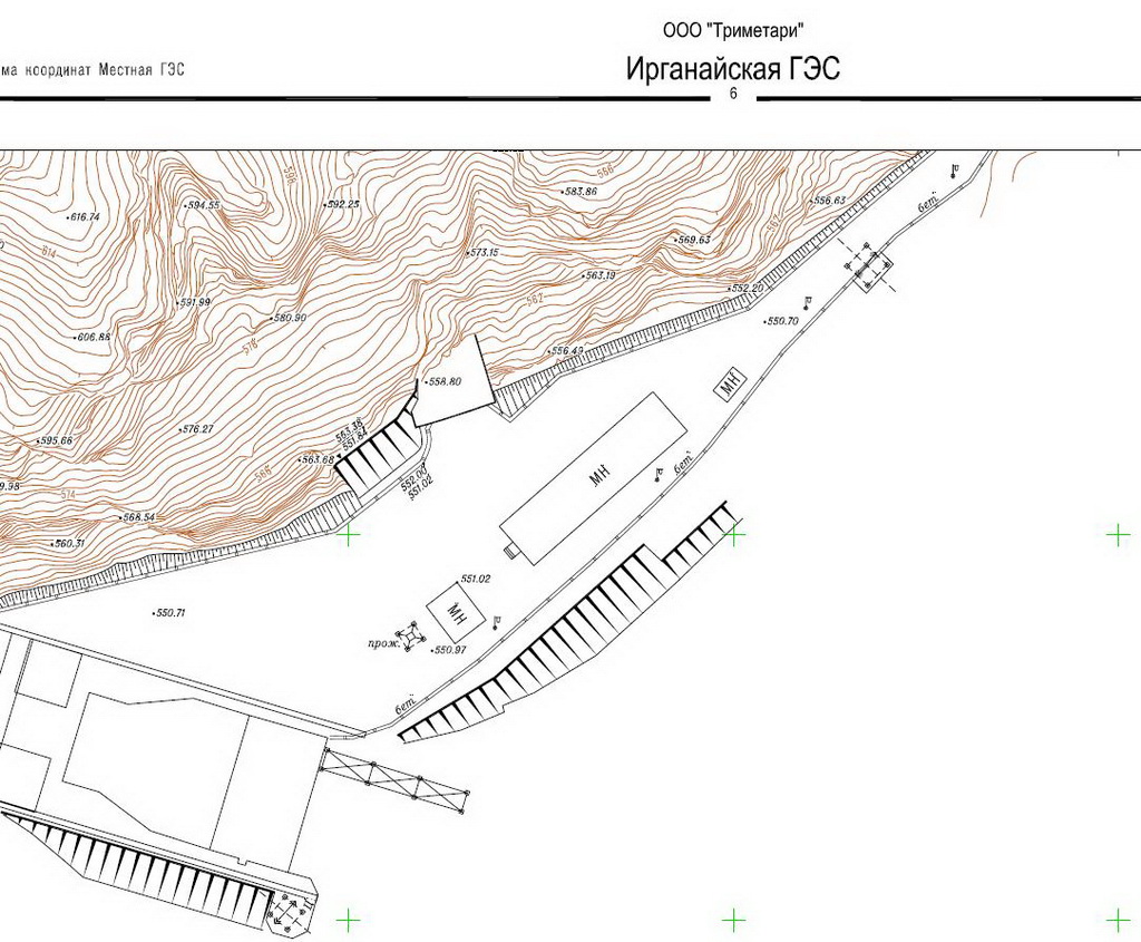
– creation of topographic map of scale 1:500.
During the filtering and segmentation incorrect and “noise” points has been removed. It is measurements that represents vegetation, precipitations and clouds.
Digital terrain model has been created by using Delaunay triangulation. Then the model has been optimised by removing duplicated triangles, artifacts and by making sizes of triangles more regular.
3D-model of engineering constructions within boundaries of laser scanning has been created by fitting geometrical entities like planes, cylinders, cones, boxes and so on into the point cloud. The final model consists of terrain model as well as 3D solid model of the intake channel and the appurtenance.
Next isolines with 1-meter step has been created on the DTM. Topomap has been designed with using convention from Russian standard. The accuracy of positioning of 3D scanner location is estimated to 10 mm. The final accuracy of the 3D-model of the rocky slope is 50 mm.
In addition to mentioned deliverables experts of Trimetari Consulting made an orthoimage of the slope in geo TIFF format. The orthoimage can be used for design of rockfall protection.
The method of 3D laser scanning is rather useful in mining geodesy, especially in surveying of open pits and mines, slopes with risk of rockfalls and landslides, volume calculations of friable materials on dumps, earthwork volumes. Wherever there is a need for high speed surveying, the object is remote and inaccessible, the laser scanning is a good soution. The result of scanning can be represented in a topomaps as well as in a 3D-mode, that can be used for analysis and mapping. Completion of this project of laser scanning of Irganayskaya HPP is an excellent proof of the feasibility and economic benefits in the application of terrestrial laser scanning in mining and topography.