 The wine trading house Camill Depre – the building of 1899, built by architect R. Kleim, is located in the center of Moscow on Petrovsky Boulevard. The two-story building has not been used for the past 20 years. On the ground floor there was a wine shop, and in the basement – a shop for bottling wine and wine cellars. The reconstruction of the building was carried out in order to reorganize it to the loft apartment. The measurement of the building by laser scanning was required to quickly create an accurate and up-to-date as-built BIM model.
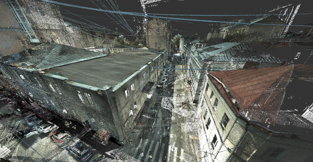
 Laser scanning was carried out by Trimetari Consulting LLC company using two scanners: Leica P20 and FARO Focus3D. Both devices operate at speeds of up to 1 million measurements per second. The Leica P20 has a longer range, so this scanner was used to measure facades and roofs, both tools worked in the interiors in parallel.
For three days of field work, a scanning of about 7,000 m2 was performed (two floors with many small rooms, a basement, and a roof). 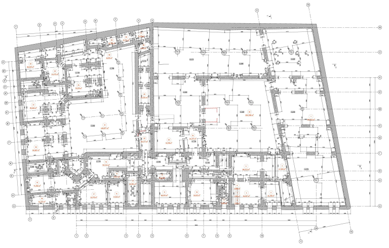 The camera built into the scanner was used on the “outside” scans, which made it possible to color each point from the cloud in the appropriate color for the object. Due to the lack of need, the camera were not used in the interior, the points were colored in the colors of the intensity of the reflected signal.
Measuring in the traditional way (using tape-measure, total station) for such an object would take much longer. Most importantly, manual measurement would inevitably contain a lot of errors. Due to the high degree of automation, laser scanning allows reducing the influence of the human factor on the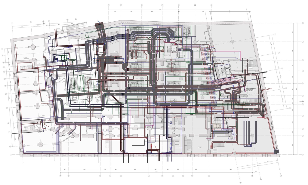 quality of an architectural measurement.
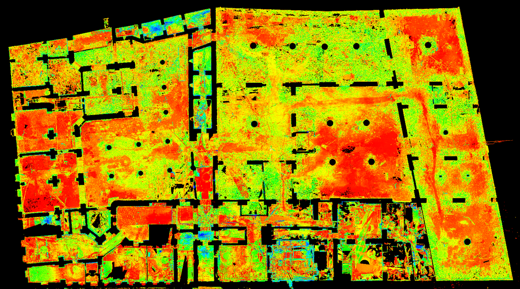
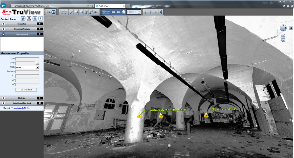
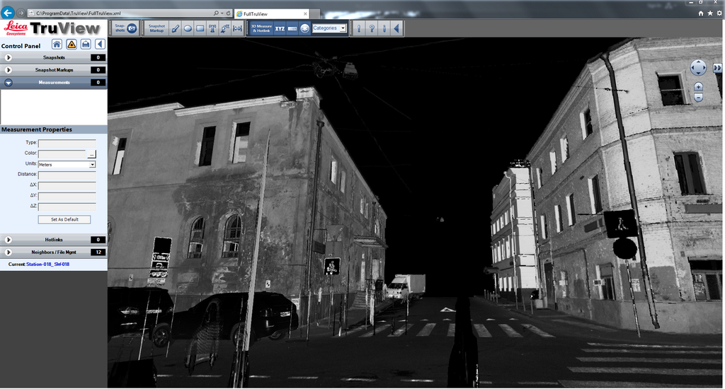
The point cloud obtained as a result of laser scanning contains detailed information about the geometry of the object: the thickness of all floors, walls, dimensions of openings, elevations, deflections of arches. Additionally, spherical panoramas of the object were formed from a point cloud using Leica TrueView software. Panoramas allow you to view the building from any point of the scan, as well as take measurements, put annotations. 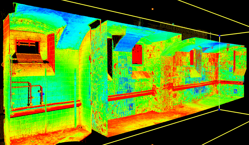 This simplifies interaction with the customer and teamwork within the project.
The point cloud obtained using Leica Cyclone was exported to Autodesk ReCap for further processing. ReCap has settings for managing a point cloud (segmentation points, highlighting, editing the intensity of the color display, etc.) and allows you to achieve the required level of detail for creation a BIM model.
 On the basis of the point cloud in Autodesk Revit, the as-built 3D-model as of 2015 was created. To create the model, the initial point cloud has been segmented and sampled. To simplify the work, the Leica CloudWorx for Revit plug-in was used, which accelerates object modeling using design recognition tools, working with fragments when creating 2D and 3D drawings, etc. Thanks to the plug-in, time was saved for creation of many objects. Structures were constructed in Revit using just a point cloud, without CloudWorx plug-in. This is a more time-consuming, but at the same time simple and failsafe way of modeling using a point cloud.
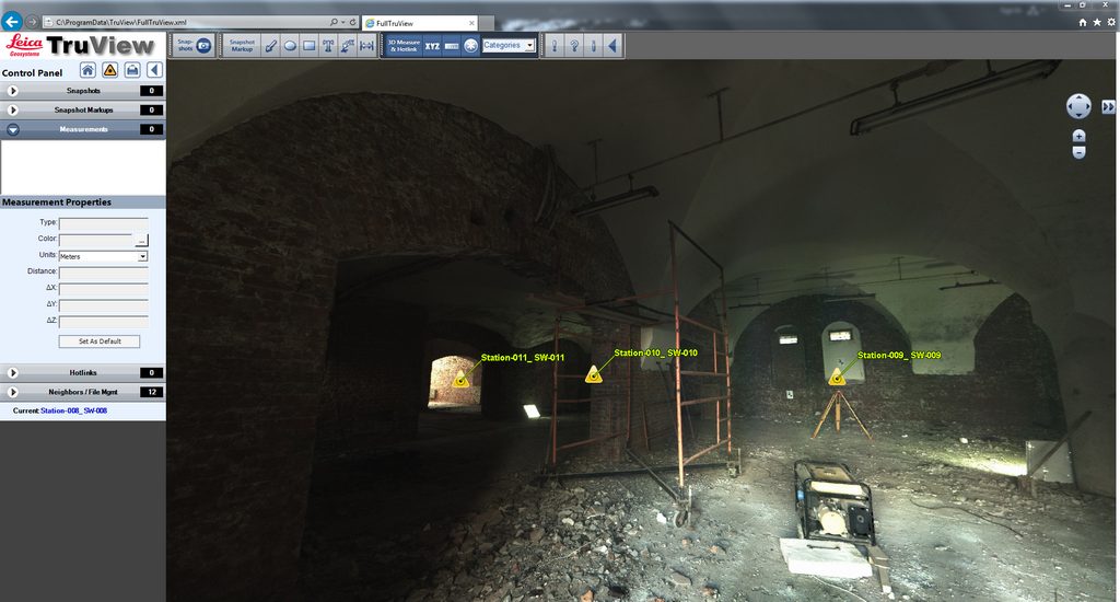 A unique feature of working with laser scanning is the complete absence of additional site visits and additional measurements. All missing measurements were taken using spherical panoramas in Leica TrueView or point cloud in Revit. It is necessary to mention the convenience of work for engineers, because the project took into account the existing transit communications passing through the basement of the building. Engineers had the opportunity to survey communications in detail using spherical panoramas in Leica TrueView, without going to the object for each question, which significantly reduced the time spent.
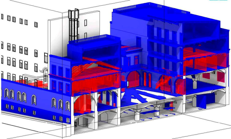
 For reconstruction in Autodesk Revit there is a very useful tool “Stage”. It allows you to set the key stages of the work in the project and attach construction and demolition of objects to them. Thus, a full-fledged BIM model of all types of work, with accurate documentation and specifications, is formed in one file. All existing objects receive the “Existing” construction stage, and if necessary, the demolition is indicated in the properties. All erected objects are created on the “New design”. This makes it possible not only to release documentation at different stages, but also to receive specifications, 3D-views with any settings for displaying elements.
 This project once again showed that modern measurement technologies can not only speed up the reconstruction process, but also avoid a large number of errors. Laser scanning technology is a powerful and very accurate measuring tool that is most effective in complex projects of reconstruction and modernization. Thanks to the BIM model, built according to laser scanning data, it is possible to carry out reconstruction and modernization with millimeter precision. And the use of the latest software products and work methods allows you to increase productivity in modeling.