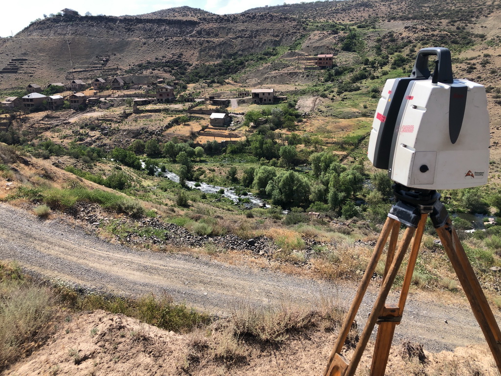
 In July 2022, Trimetari Consulting engineers, commissioned by Gazprom Geotechnology, completed the next cycle of mine surveying and geodetic monitoring of the development of landslide processes in landslide-prone areas of the mining allotment of the Abovyanskaya UGSF using laser scanning systems. The work was carried out in order to ensure industrial safety and protection of subsoil during the operation of the Abovyan underground gas storage station. The specialists obtained quantitative characteristics of the landslide movement in order to identify the growth or attenuation of the landslide process, its modeling and forecasting. The data obtained are also used to develop anti-landslide measures. (read more…)
Industrial construction
Laser Scanning and 3D Modeling of the Vyksa Steel Works
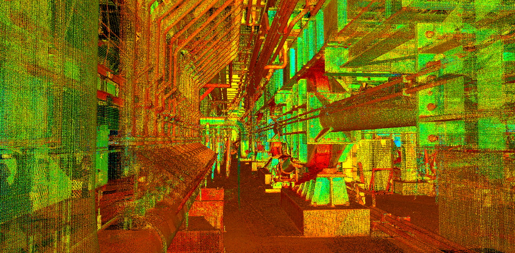 In January 2018, the company Trimetari Consulting LLC carried out work on laser scanning and 3D modeling of the under-furnace space of walking-type furnaces of the Vyksa Steel Works. The aim of the work is to produce a geometric 3D model in the Autodesk DWG file format for further design of the furnace cleaning system. (read more…)
Laser Scanning and BIM-modelling of the Oil Pump Station Salym Petroleum, Tyumen region, Russia
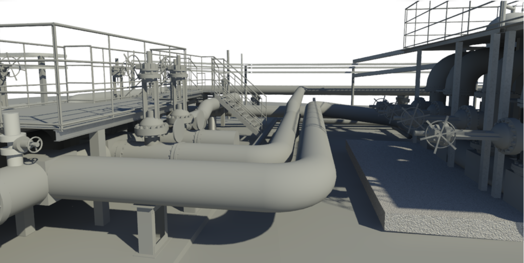 In January 2018 the specialists of Trimetari Consulting LLC performed the work on laser scanning and creation of the BIM-model of the multiphase pumping station located on the territory of the Upper Salym oil field, Khanty-Mansiysk Autonomous District. The history of Salym field, located in the Tyumen region, Russia, began almost 20 years ago with a little development and has reached our days as a major project for oil production. The annual production volume exceeds 6 million tons. (read more…)
Laser Scanning for BIM of Bogoliubovsky Mining Plant, Krasnoyarsk territory, Russia
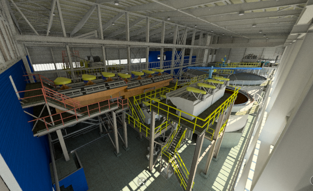 In January 2016, Trimetari Consulting LLC performed laser scanning of the main building of Bogoliubovsky Mining and Processing Plant, which processes gold-sulfide and gold-antimony ore. The purpose of the work is to create an executive BIM-model of the facility. The industrial building with an area of more than 3000 m², multi-level structures, technological equipment and communications were scanned in 2 days. The resulting point cloud was later used to build an accurate and up-to-date BIM model of the factory. (read more…)
Laser scanning for intelligent modeling of Rostov Nuclear Power Plant
 Despite the fact that the first ground-based scanners appeared back in the last century, one can hardly say that a 3D-scanning laser technology is widely used in the design and construction of industrial facilities. The main reasons are probably the cost of such systems which is still high and the lack of information about how to use them effectively in particular applications. Nevertheless, interest in this technology and demand for it on the market of surveying equipment is growing in geometric progression with every year, and the high cost of the acquisition is more and more compensated by the offers from scanning services providers.
Depending on the project goals and objectives, the laser scanning technology can be effectively combined with 3D-design technologies. (read more…)
3D Laser Scanning of Southwestern Heat and Power Plant
 In February 2013 Trimetari Consulting LLC performed a geodetic survey of the first power unit of the Southwestern CHP Plant with the use of terrestrial laser scanning . The Southwestern Combined Heat and Power Plant is located in Saint Petersburg, Russia. Laser scanning of existing facilities was carried out in order to create AS-BUILT 3D model for the design of the second stage of the power plant.
(read more…)
Topographical Survey of Irganaiskaya Hydroelectric Power Plant by 3D Laser Scanning
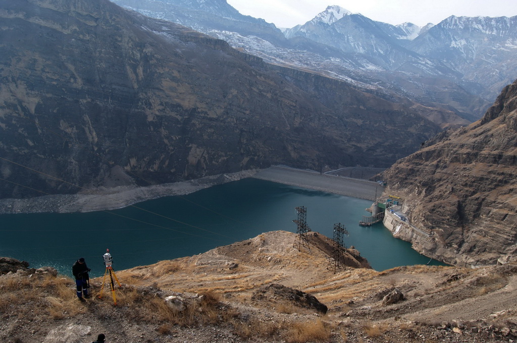
In February and March 2012 Trimetari Consulting performed engineering survey by 3D laser scanning of the rocky slope that is placed above the intake channel and the appurtenance of Irganaiskaya hydroelectric power plant, Dagestan region, Russia. Due to needs of the customer, RusHydro corporation, the work was carried out to obtain topographic maps of scale 1:500 and a three-dimensional terrain model. The 3D-model should be suitable for further detailed engineering geological zoning of the slope, as well as to ensure the design work of rockfall protection. (read more…)
Share this page: