 Pulkovo is the only airport in St. Petersburg, the third largest in Russia in terms of passenger traffic. The airport has two terminals: Pulkovo-1 is designed to serve passengers of domestic flights and part of flights departing outside Russia, Pulkovo-2 – international airlines.
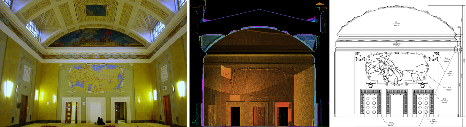
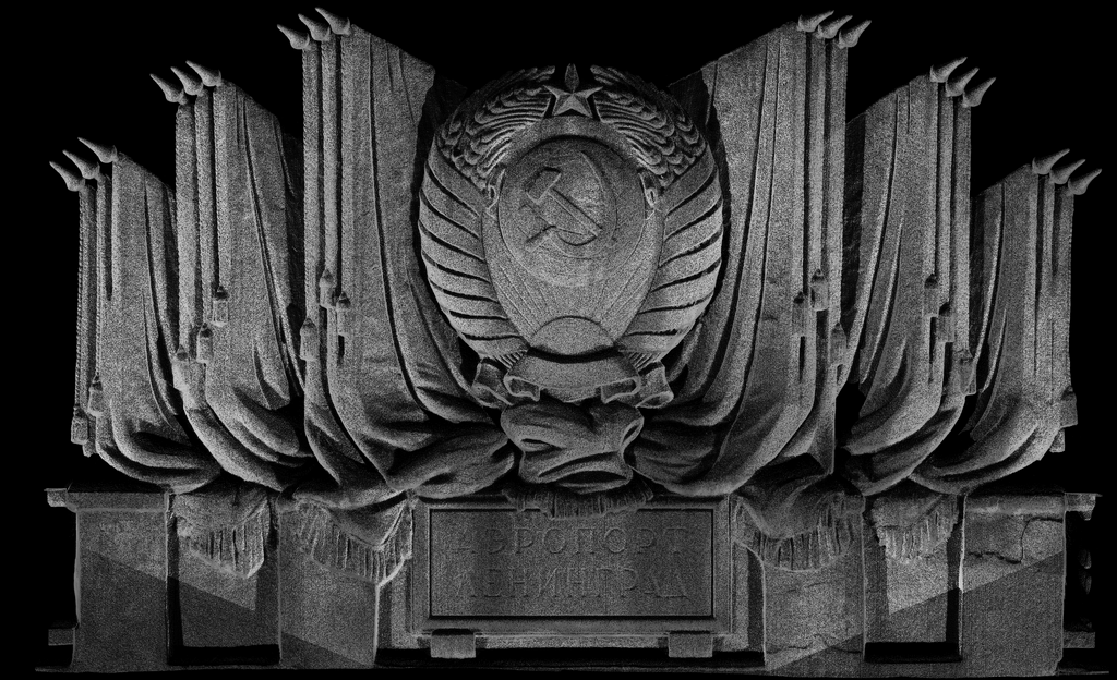
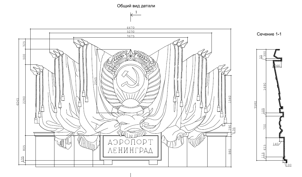
An architectural monument of Stalinist neoclassicism – the Shosseinaya airport terminal (the name of the airport until the seventies), built in 1951 to the project of architect A.I. Gegello. The interiors of the central hall and a number of rooms are finished with a lot of decor, ceilings with picturesque panels, bas-reliefs.
In connection with the start of a large-scale project to reconstruct St. Petersburg’s air gateway, the old airport terminal building is to be restored and repurposed for modern needs while preserving all historical elements of the facades and interior spaces. A typical task for 3D laser scanning is to obtain an array of data for the subsequent preparation of design documentation in a short time and with little funding. In December 2011, Trimetari specialists were entrusted with the architectural measurement of the monument by laser scanning.
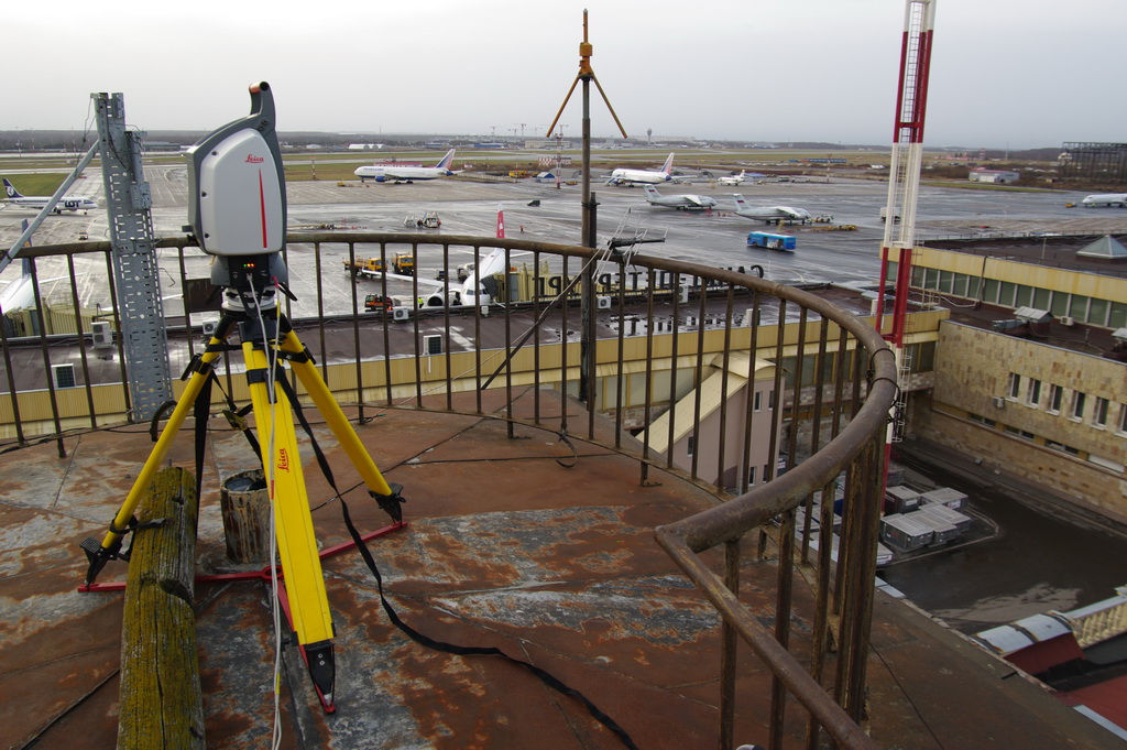
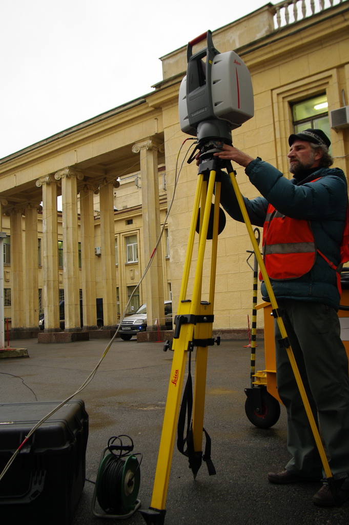 As a result of the field phase, a point cloud was obtained, combining measurements taken from 24 stations – the laser scanner standing points. Some of the stations were located outside to measure facades, some inside to measure interiors, and some on the roof of the building. In order to combine the data obtained from different stations into a single coordinate system, the backsighting method was used. For its implementation, special marks are placed on the facades and interiors of the building, the coordinates of which are measured with a total station. For this purpose, a tachymetric traverse was initially made, closed and equated around the building and along the interiors that were subjected to architectural measurements. This is a very peculiar task, given the number of storeys, the scattering of rooms with historic interiors throughout the building and the presence of staff inside and technicians outside – the building is in full operation for its intended purpose, despite the renovation that has begun.
 The field team then proceeds directly to laser scanning, during which the coordinates of the centres of the stamps are measured (already by the scanner) from each station. Subsequently, at the desktop processing stage, each stamp is assigned a coordinate value taken from the total station, which makes it possible to obtain the parameters of the affine transformation for each station if the number of stamps is sufficient. The transformation process is sufficiently automated, the user only has to pay attention to the quality control of stitching scans, calculate errors. In our case, the average value of the absolute error of station registration was 3 mm, which is typical for objects of similar size and configuration.
 Quite a long period of 1 week for the field work on the site was due to the difficulties associated with the peculiarities of admission to the site. Part of the internal premises and yards are located in the customs regime zone, which necessitated multiple daily ‘border crossings’ with all formalities from document presentation to personal inspection. When closing the geodetic passage, it was necessary to cross the Russian state border several times a day.
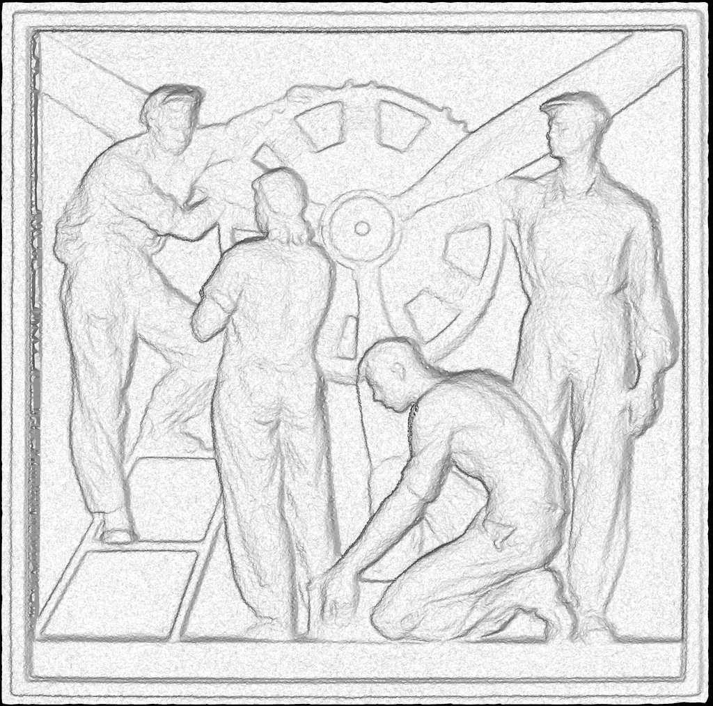 The peculiarity of the project is that the customer, who was the architectural and restoration workshop, received orthoimages rather than ready-made drawings, which he finalised himself. An undeniable advantage of this approach is the speed of delivery of materials and the relatively low cost of the work. In addition, architects have the opportunity to produce measurement drawings according to their own requirements. Therefore, the cameral stage was not long, the creation of orthoimages, unlike the drawing of finished drawings, requires a minimum of operator participation. As a result of the desktop phase, more than 360 orthoimages of facades, interiors, and details were created with a total volume of more than 20 GB.
As a result of the architectural measurement of the airport terminal building, the customer promptly received accurate and detailed orthoimages, on the basis of which he independently created measurement documentation. The documentation is being approved by the Committee for State Control, Use and Protection of Historical and Cultural Monuments and is currently being used to design the reconstruction.