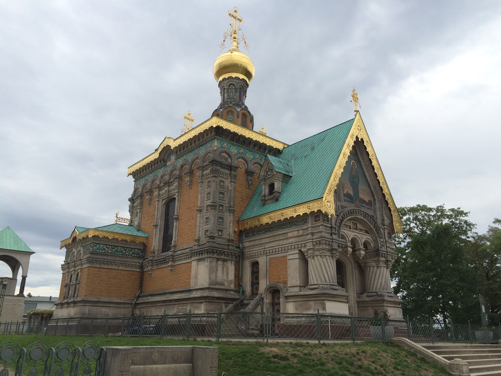
 The Church of St. Mary Magdalene is the Orthodox Church in Darmstadt, Germany. The decision to build a church in the land of Hesse was caused by the desire of the last Russian Emperor Nicholas II and Alexandra Feodorovna (nee Princess of Hesse-Darmstadt) to be able to visit the Orthodox church during their stay at the Empress’s homeland. Before the construction the hill was piled up. For this purpose it was brought about 400 wagons of soil collected in different provinces of the Russian Empire. Granite also has been brought to Darmstadt – from the Urals, the Caucasus and from Siberia. Architects determined that the church should be literally from the Russian stone and stand on Russian soil.
 The Church was built by Russian architect Leon Benois on personal means of the royal family. September 26 (October 8), 1899, the temple was consecrated in the name of the Equal-to-the-Apostles St Mary Magdalene. In 1938 the church in Darmstadt was transferred to the “Diocese of the Orthodox bishops of Berlin and Germany” of the Russian Orthodox Church Abroad.
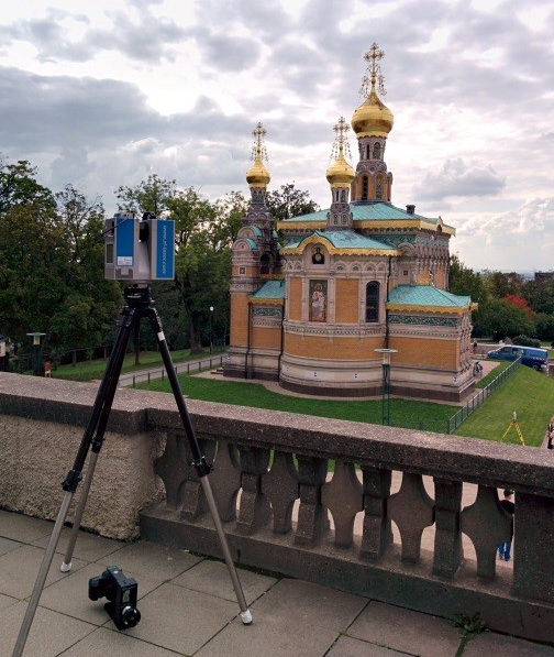
In 2015, Metropolitan of Nizhny Novgorod and Arzamas Georgy blessed to build in Diveevo a copy of the Church of St. Mary Magdalene. To measure the original building, it was decided to use the laser scanning method, a contractor competition was held, according to which the company Trimetari Consulting LLC was declared the winner. In September 2015, the company’s specialists have already started work on architecture measurements.
Work on laser scanning was carried out in two stages: field and office.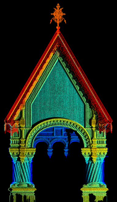 Field stage is laser scanning and photo shooting. For 3D scanning, the Z + F Imager 5010C scanner as well as the Leica Viva series total station and the panoramic HDR camera were used. The tacheometer was used to create a temporary geodetic network. To obtain a full point cloud of façade points and interior spaces, 43 stations (laser scanner standing points) were required. At each point, laser scanning was taken and a HDR camera was photographed.
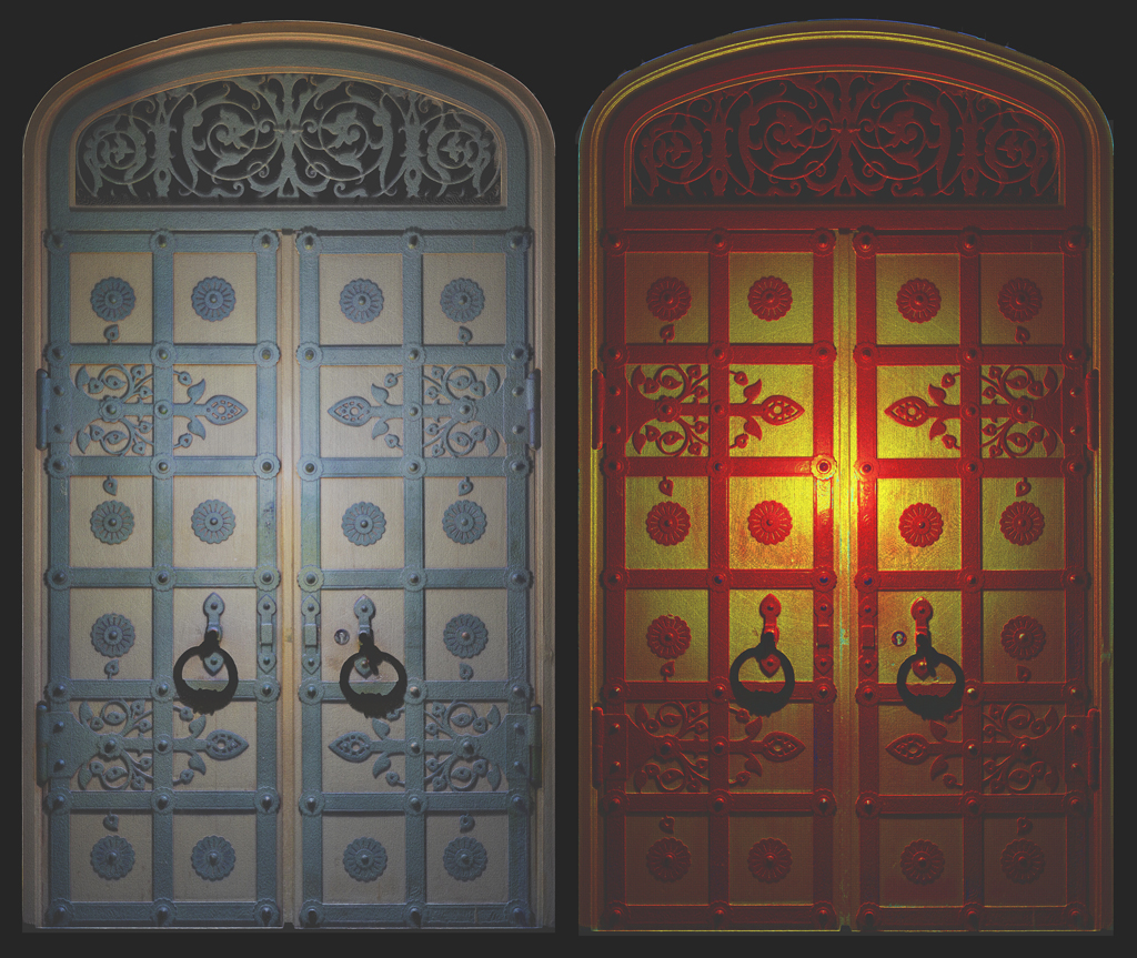
Subsequently, HDR panoramas were used to color the point cloud into real colors, as well as to fix the current state of the architectural monument. The external panoramic camera allows you to shoot faster and, most importantly, better than the camera built into the scanner. The presence of a 3D virtual copy of the object in the form of a point clouds and a set of HDR-panoramas allowed to minimize repeated trips to the site for additional measurements and surveys. This reduces the duration and cost of construction work. The effect of using laser scanning at this facility was quite high, since both the design and construction organizations are located in the Nizhny Novgorod region. It is more than 2,000 kilometers away from the object of research.
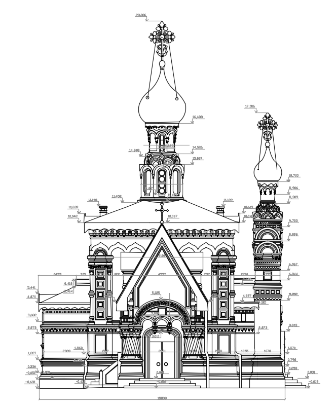
 The office phase of the work included registration of laser scanning data, point cloud processing, a creation of orthoimage and architecture measurement drawings. Orthoimage is the orthogonal projection of a point cloud (a building or structure) onto a given plane. This method of architecture measurement of buildings simplifies the preparation of measurement drawings and allows maximum avoidance of errors and inaccuracies. In the process of working with orthoimages, it is possible to instantly check with point cloud, make additional cuts or projections.
The results of laser scanning were provided to the customer in the form of a point cloud in the Autodesk RCP file format, spherical panoramas of Leica Truview with the possibility of measurements and annotation, as well as a set of measurement drawings in the Autodesk DWG format: facades, cuts, plans and fragments. 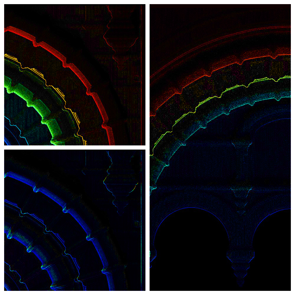 Dimensional documentation was used for design and construction work on a new church. In 2016 crosses were already installed on the new church built.
Trimetari Consulting LLC provides laser scanning services in Russia, CIS countries, Europe and Asia. A significant part of the company’s work falls on as-built surveying by laser scanning and architecture measurement.
Architecture measurement is used for the design of restoration works, as well as for delivery of materials to the governmental agencies of monuments protection. Terrestrial laser scanning, as a branch of engineering syrveying, is advanced technology and is characterized by high speed and accuracy of measurements and is the best suited for work with objects of cultural heritage.